
Profile
This page contains affiliate links. If a listed item is purchased, a commission may be earned at no extra cost.
The peninsula after the treaty
California passed from Mexico to the United States under the Treaty of Guadalupe Hidalgo in 1848. The treaty said existing land grants would be respected. In practice the next decades were a long argument over what that sentence meant on the ground. The Land Act of 1851 required every claimant under a Spanish or Mexican grant to file a petition with the Board of California Land Commissioners and prove the grant was valid. Many titles were incomplete, poorly surveyed, or already sold more than once. Courts, lawyers, and cash decided most of the outcomes. On the Monterey Peninsula the process concentrated large holdings in a small number of hands.
One of those holdings was Rancho Pescadero, the tract that later became most of Pebble Beach. By 1840 it belonged to Carmen García Barreto y Madariaga, a widow. In 1846 she sold roughly four thousand acres for five hundred dollars. The sale did not end the title questions. Other claims appeared. The land passed through intermediate owners. When the American system of confirmation and patent finally closed, the tract was in the hands of David Jacks.
Jacks had arrived in Monterey in the early 1850s as a young Scottish immigrant. He worked as a clerk, then as county treasurer. He also lent money. Ranchers who needed cash to pay new American taxes or to defend their grants often used their land as security. When payments were missed, Jacks foreclosed. He watched tax sales. He bought claims. By the late 1860s he controlled tens of thousands of acres across Monterey County, including most of the peninsula that lay between Monterey and Carmel.
The single largest stroke was the 1859 sale of the pueblo lands of Monterey. The city owed its attorney, Delos R. Ashley, roughly a thousand dollars for work confirming its own title. The trustees advertised an auction to raise the money. The notice ran in a Santa Cruz paper; Monterey had none. Ashley and Jacks were the only bidders. On 9 February 1859 they took the entire remaining pueblo tract, nearly thirty thousand acres, for one thousand two dollars and fifty cents. The city later sued, arguing the sale was irregular. The case reached the United States Supreme Court, which ruled for Jacks in 1906, long after the practical control of the land had already been settled. Ashley transferred his interest to Jacks in 1869. From that point Jacks held the core of the peninsula outright.
The same pattern appeared on the specific ranchos that became the Del Monte Forest and the shore of Carmel Bay. Rancho Pescadero had its own tangled history of double sales and competing claimants. Jacks acquired it through a combination of purchase and litigation. By the 1870s he was the landlord of record for the shoreline where a small Chinese fishing camp stood in shacks on the granite at what was then called Stillwater Cove. He collected rent. He did not live on the land. He treated it as inventory.
Jacks was not the only actor. The Methodist Episcopal Church received land from him for the Pacific Grove retreat in the mid-1870s. Other buyers took smaller parcels. But the scale of his holdings meant that when the Pacific Improvement Company arrived in 1880 looking for a large coastal tract for a hotel and for subdivision, Jacks was the person who could deliver it. He sold them approximately seven thousand acres between Carmel and Pacific Grove for about thirty-five thousand dollars. The company was the property arm of the four men who controlled the Central Pacific and Southern Pacific railroads: Charles Crocker, Collis Huntington, Mark Hopkins, and Leland Stanford. They already moved freight and passengers. They now intended to create a destination at the end of the line.
The sale closed a chapter that had begun with the Treaty of Guadalupe Hidalgo. In little more than thirty years the land had moved from a Mexican rancho held by a widow, through the uncertain machinery of American land confirmation, into the hands of a single Scottish-born lender and then into the portfolio of the railroad’s real-estate company. The Chinese fishermen who dried squid and abalone on the rocks had paid rent first to Jacks and later to the Pacific Improvement Company. Their houses belonged to them; the ground did not. When the company decided the ground was more valuable as residential lots and as the setting for a luxury hotel, the legal power to make that decision already rested with the new owners.
The hotel opened in June 1880, the same year as the purchase. The carriage drive that would later be called 17-Mile Drive was laid out the following year as an amenity for the guests. Both projects sat on land whose title had been assembled in the years immediately after the Mexican-American War by men who understood how to use courts, auctions, and unpaid debts. The cypress that stood on the granite at Midway Point had been growing there through the entire process. It did not change owners. The land under it did.
Chinese fishermen on the rocks
Chinese immigrants were the first people to work Monterey Bay as a commercial fishery. They arrived in the early 1850s, after the Gold Rush had already drawn large numbers of Chinese men to California. Most came from the Pearl River Delta region of Guangdong province. They knew how to catch, dry, and salt fish for long-distance markets. On the Monterey Peninsula they found a coastline rich in abalone, squid, rockfish, shrimp, and seaweed, and almost no one else fishing it at commercial scale.
The earliest camps were small and temporary. One account places a group of fishermen at Point Lobos around 1851 after a shipwreck. From there they moved to other coves. By the mid-1850s a settlement of roughly thirty people lived in shacks built on the granite at Pescadero, the place later called Stillwater Cove, on the shore that would become part of Pebble Beach. The men fished from small sampans, dried their catch on the rocks, and shipped the product by coastal steamer or wagon to San Francisco. They paid rent to whoever held the land title. At first that landlord was David Jacks. After 1880 it was the Pacific Improvement Company.

Power for the slow stretches. A compact solar generator and panel combination that keeps phones, cameras, and a small cooler running without hunting for an outlet on a private coastal loop. See the Jackery Solar Generator 300 on Amazon
A second, much larger village grew at Point Alones, on the waterfront between Monterey and Pacific Grove. This was not a seasonal camp of crews. Families lived there. Houses lined the shore. By the 1870s and 1880s Point Alones held several hundred people and was one of the largest Chinese settlements in California outside San Francisco. Residents owned their buildings and paid ground rent to the landowner. They fished at night with torches and pitchwood fires hung over the water to draw squid to the surface. They gathered abalone, dried fish and seaweed, and sold both locally and in the San Francisco market. By the late 1860s the tonnage leaving Monterey Bay was already being recorded in commercial statistics.
Quock Mui was born in 1859 at Point Lobos, the first documented Chinese person born on the peninsula. She grew up speaking Chinese, English, Spanish, Portuguese, and Rumsen. At seventeen she married and moved with her husband to the smaller camp at Pescadero Point. Their first child was born there. Later the family relocated to Point Alones, where the rest of their children were raised. After the 1906 fire she and her family moved again, this time to McAbee Beach. She lived in all four of the main Chinese fishing sites on the peninsula. Her life traced the successive places where the community was allowed to remain.
The work was hard and the legal position was weak. From the 1870s onward local non-Chinese fishermen and townspeople pressed for restrictions. Laws limited the hours Chinese crews could fish, the gear they could use, and the markets they could sell into. Newspapers ran stories that treated the villages as nuisances. These local measures sat inside a national policy that culminated in the Chinese Exclusion Act of 1882, which barred most Chinese laborers from entering the United States and made re-entry difficult for those already here. Families at Point Alones continued to fish and to pay rent, but the political climate around them grew colder.
Hotel Del Monte guests were sometimes taken to see the villages. The abalone shells and dried fish were curiosities for people who had arrived by train for a holiday. The same company that owned the hotel and the land under the camps also owned the railroad that carried the guests. The fishermen were useful as long as their presence did not interfere with plans for residential lots and resort development. When those plans matured in the early 1900s, the Pacific Improvement Company began formal steps to clear the Point Alones site.
The smaller camp on the Pescadero rocks had already dwindled. Its location on the future 17-Mile Drive shore made it especially visible to carriage parties, but it never grew into a permanent village of families the way Point Alones did. Both places, however, were part of the same economy: Chinese labor extracting marine products from a bay that had not been fished commercially before they arrived, on land whose title had been assembled by American owners after 1848. The dried squid and abalone that left the peninsula in the 1860s and 1870s traveled the same routes the railroad would later use for tourists. The people who produced them lived on ground they did not own, under a legal system that was steadily narrowing their options.
The railroad company takes the land
In 1880 David Jacks sold approximately seven thousand acres between Carmel and Pacific Grove to the Pacific Improvement Company for roughly thirty-five thousand dollars. The company was the real-estate arm of the four men who controlled the Central Pacific and Southern Pacific railroads: Charles Crocker, Collis P. Huntington, Mark Hopkins, and Leland Stanford. They already owned the tracks that brought passengers and freight into California. They now intended to own the place at the end of the line where those passengers would spend money.
The purchase was not a speculative gamble on empty coastline. The company already knew the value of a destination hotel. Construction of Hotel Del Monte began the same year. The building opened on 3 June 1880. It was large, wooden, and deliberately remote. Critics in San Francisco called it Crocker’s Folly. They argued that the peninsula was too far from any existing city, that a wooden hotel on the edge of the forest would never fill, and that a railroad should end at a depot rather than at a resort porch. The hotel filled anyway. In the first season thousands of bookings were turned away. President Rutherford B. Hayes stayed in September 1880 and became the first sitting American president to visit California. The visit confirmed what the company already understood: people with money would travel for the climate, the view, and the status of having been there.
Hotel Del Monte was both a resort and a sales instrument. Guests arrived by train with trunks. They walked out of the hotel onto a porch that faced the woods and the distant water. From that porch the company could show them the surrounding land. The lots were not yet subdivided in the modern sense, but the land was already surveyed enough for the company to point out future building sites. An afternoon carriage ride through the forest and along the shore made the point more effectively than any map. The ride began the following year, in 1881. It was not offered as a public road. It was an amenity for people who had already paid to stay at the hotel. Parties of twenty or forty coaches left together. The lead driver chose the line. The distance varied with the exact streets used through Monterey and Pacific Grove, but the name that eventually stuck was 17-Mile Drive. Other names—Scenic Drive, 16-Mile Drive, 18-Mile Drive—appeared in newspapers for a few years. By 1883 the number seventeen had settled into common use.

Charge for the camera and the map. A high-capacity power bank that keeps a phone, tablet, and roof-mounted camera alive through a full daylight loop without draining the car battery. See the Anker Prime Power Bank on Amazon
The woods the coaches entered were first called the Hotel Del Monte Park Reservation. They later became known as Del Monte Forest. The name marked the shift from open rancho land to company property managed for recreation and eventual sale. Monterey cypress and pine already grew on the headlands and in the interior. The company did not plant the original forest. It enclosed it, improved the carriage roads, and presented it to guests as part of the hotel experience. The Chinese fishing camp that still stood on the rocks at Stillwater Cove became one of the sights the coaches passed. Guests sometimes stopped to look at the shacks and the drying racks. The company collected rent from the fishermen while it decided how the same shoreline would be marketed to future lot buyers.
The hotel itself did not last in its original form. It burned in 1887 and was rebuilt. It burned again in 1924. The 1926 replacement eventually became Herrmann Hall at the Naval Postgraduate School. The porch the first carriage parties left from now sits behind a security gate. The Pacific Improvement Company, however, had already accomplished its main purpose. It had turned a large coastal tract acquired from a single landowner into a known destination. Guests who stayed at the hotel saw the forest and the shore under company guidance. Some of them later bought land. Others simply returned the next season. The railroad that carried them also carried the dried fish and abalone that the Chinese crews had been shipping for decades. The same tracks now carried people who paid to look at the place where that work had been done.
By the time automobiles replaced carriages, the basic arrangement was already fixed. The company owned the land, the hotel, and the road that looped through both. The original outing had been designed so that guests would see the lots. The later paved version of the same loop continued to show those lots, now occupied by houses and golf courses, to a different kind of visitor. The title that Jacks assembled after 1848 and sold in 1880 had become the foundation for a private resort community. The cypress on the granite at Midway Point remained where it had always stood. The land around it had changed owners twice in a single generation.
An outing for the guests
The drive that later took the name 17-Mile Drive began in 1881 as an afternoon carriage outing for guests of Hotel Del Monte. It was not a public highway and it was not intended as one. Carriages left the hotel porch, passed through the streets of Monterey and Pacific Grove, entered the woods of what was then called the Hotel Del Monte Park Reservation, followed the shore where the alignment allowed, and returned to the same porch before dark. The purpose was to let people who had already paid for a room see the surrounding land under company guidance.
Parties of twenty or forty coaches often left together. The lead driver chose the exact line. No single surviving map fixes the first route through the towns. A former archivist at the old hotel later said he never found one exact path through Monterey. The distance varied. Contemporary accounts put it anywhere from about fourteen miles to twenty, depending on which streets were used and how far the coaches followed the water. The number that eventually stuck in the name was not the product of a precise survey. It was a round figure that sounded finished.
Other names appeared in print for a few years. Newspapers called the outing Scenic Drive, 16-Mile Drive, and 18-Mile Drive. A San Francisco paper was still using the figure eighteen in 1901. By about 1883 the name 17-Mile Drive had become the ordinary way to refer to it. The woods the coaches entered were company property. They were managed as a reservation for the hotel rather than as open range or as a town park. Monterey cypress and pine already stood on the headlands and in the interior. The company improved the carriage tracks, cleared some undergrowth, and presented the forest as part of the hotel experience. Guests who stayed for a week could take the drive more than once. Some stopped to picnic. The place later called Midway Point was one of those pauses, roughly halfway around the circuit, where coaches halted so passengers could eat before turning back toward the porch.
The original route used the towns. It left the hotel, moved through Monterey, continued into Pacific Grove, then entered the forest and the shore. The present loop that visitors pay to drive lies almost entirely inside Del Monte Forest. It does not begin at the old hotel porch and it does not pass through the center of either town. The change happened gradually as the company developed the land and as automobiles replaced carriages. By the early twentieth century the signed circuit that could be entered at gates already resembled the route used today more than it resembled the first carriage outings. The towns remained visible from certain points, but they were no longer part of the official path.
The outing was also a sales device. The land the coaches passed had been purchased from David Jacks the year before the hotel opened. Much of it was still unsold. Guests who saw the shore and the forest from a moving carriage were more likely to inquire about building sites than guests who only looked at a map in the hotel lobby. The Chinese fishing camp that stood on the rocks at Stillwater Cove was one of the sights. Passengers could see the shacks and the drying racks from the road. The same company that owned the hotel and organized the drive also collected rent from the fishermen. The presence of the camp did not prevent the company from showing the adjacent land to potential buyers. It simply formed part of the existing shoreline until the company decided the ground was more valuable without the shacks.
Hotel Del Monte burned in 1887 and was rebuilt. It burned again in 1924. The 1926 replacement eventually became Herrmann Hall at the Naval Postgraduate School. The porch the first carriage parties left from now requires permission to approach. The road the coaches followed outlived the porch. By the time the second hotel stood, automobiles were already common and the drive had become a slower, more contained circuit through company land. The original afternoon outing for people who arrived by train with trunks had turned into a paid loop that anyone with a car could enter at a gate. The forest and the shore remained the same. The way visitors were allowed to move through them had changed with the ownership and with the vehicle.
Point Alones and the end of the village
Point Alones stood on the waterfront between Monterey and Pacific Grove, on land that first belonged to David Jacks and later to the Pacific Improvement Company. Unlike the small seasonal camp of about thirty people who lived in shacks on the granite at Pescadero, Point Alones was a permanent village of families. Houses lined the shore. Residents owned the buildings and paid ground rent to the landowner. By the 1870s the settlement held several hundred people and functioned as the main Chinese community on the peninsula. It was larger than most Chinatowns in California outside San Francisco. People fished, dried and salted their catch, repaired nets, and raised children. Quock Mui, born at Point Lobos in 1859, lived there for years with her husband and children after earlier stays at the smaller camps.
The village sat on company land after 1880. The Pacific Improvement Company collected the rent while it developed Hotel Del Monte and began to market surrounding parcels. For more than two decades the arrangement continued. Guests from the hotel were sometimes driven past the village or taken to see it. The abalone shells and the night fishing with torches were treated as local color. At the same time, non-Chinese fishermen and townspeople in Pacific Grove and Monterey pressed for restrictions. Local ordinances limited fishing hours and gear. Newspapers described the settlement as a nuisance. These local pressures existed inside the national policy set by the Chinese Exclusion Act of 1882, which had already made new immigration difficult and re-entry uncertain. The families at Point Alones kept fishing and paying rent, but their legal position grew narrower.

Light for the early or late stop. A rechargeable tactical flashlight with long throw and high output for checking the overlook or the side of the road when the marine layer drops early. See the Fenix PD40R V3.0 on Amazon
By 1905 the company had decided the site was more valuable as residential lots than as a fishing village. It began formal negotiations to relocate the residents. The company proposed moving them to a stretch of beach near Seaside. Representatives of the village, including American-born men such as Quock Tuck Lee, asked for more time to find a suitable place. The company set deadlines and then extended them. No agreement was reached. In May 1906 a fire burned through the village. Contemporary accounts called the origin suspicious. Some later writers treated it as arson intended to force the residents out. The evidence remains circumstantial. What is clear is that the fire destroyed most of the houses and that the Pacific Improvement Company then refused to allow rebuilding on the same ground. The remaining residents were evicted.
About half the families moved a short distance to McAbee Beach, on Ocean Avenue in what later became Cannery Row. They leased land from John McAbee and built again. Some continued to fish. Others found work in the canneries that were beginning to appear along the waterfront. Quock Mui and her family were among those who relocated to McAbee Beach. The original Point Alones site was cleared. The company proceeded with its plans for the property. The same year, the San Francisco earthquake and fire damaged Hotel Del Monte, but the two events were separate. One was a natural disaster that affected the resort. The other was a fire followed by an eviction that removed a long-standing community from company land the company now wanted for other uses.
The smaller camp at Pescadero on the future 17-Mile Drive shore had already faded. It never grew into a village of families the way Point Alones did. Both places, however, illustrated the same sequence. Chinese fishermen established the first commercial fishery on Monterey Bay in the 1850s on land they did not own. They paid rent first to Jacks and later to the railroad’s property company. They built houses and raised children while the legal and political climate around them tightened. When the company decided the shoreline was ready for residential development and for the continued marketing of the hotel and its carriage drive, it had the title and the local support to clear the larger village. The dried fish and abalone that had left the peninsula for decades continued to be produced by some of the same families at their new location. The ground they had occupied at Point Alones did not remain a fishing village. It became part of the developed waterfront the company and its successors controlled.
From horses to motorcars
Carriages remained the ordinary way to travel the drive well after automobiles had appeared on other California roads. Hotel Del Monte kept a large stable. Guests who wanted to see the forest and the shore still left the porch in coaches. Parties continued to form in the 1890s and the first years of the new century. The road itself had not been built for speed. Its curves followed the edge of the woods and the line of the cliffs. Its surface was graded for horses. The purpose of the outing had always been to let people look at the land the company owned. That purpose did not change when the first motorcars arrived.
Benjamin Harrison took the six-horse coach through the reservation in 1891 while he was president. Theodore Roosevelt, visiting later, chose a stallion from the hotel stables rather than a carriage. Both visits were recorded because the men were presidents. Ordinary guests made the same choice every week: coach or, less often, saddle horse. The early Pebble Beach Lodge, which opened in 1909, still provided space for both. Horses were listed alongside the new machines. The argument over which vehicle belonged on the road lasted into the 1910s. By the end of that decade the carriages had largely disappeared from the regular outing. The pavement remained.
The speed limit that later settled at twenty-five miles an hour was not an arbitrary restriction added for safety. It preserved the original function of the road. A coastal loop can be looked at or it can be crossed. The company had built the drive so that guests would see the lots, the forest, and the shore. Twenty-five miles an hour is the speed at which a person in an open car can still register the shape of a cypress, the color of the water, and the line of a fence. Faster travel would have turned the outing into a transfer between gates. The company had no interest in that result. The road stayed slow because looking was still the product being sold.
The transition did not erase the earlier geography. The original carriage route had left the hotel, moved through Monterey and Pacific Grove, entered the woods, followed the water where the alignment allowed, and returned to the porch. As automobiles became common, the company adjusted the signed circuit so that it lay almost entirely inside Del Monte Forest. Gates appeared. The towns dropped out of the official path. Visitors no longer needed to start at the hotel. They could enter at Pacific Grove, at Carmel, at the Highway 1 gate, or at the Country Club entrance, pay the fee, and follow the marked loop. The forest interior, the stretches of open water, and the rail above the tree at Midway Point remained the sequence that justified the drive.
The same years saw the land around the road change use. Samuel F. B. Morse and the Del Monte Properties Company took control after 1919 and began to develop the residential lots and the golf courses that now define Pebble Beach. The early lodge of 1909 grew into a larger resort presence. Houses appeared behind the fences that lined parts of the drive. The road itself continued to function as the device that let outsiders see the result. Motorcycles were later prohibited. Bicycles were sometimes allowed and sometimes restricted, depending on the year and the gate. The consistent rule was that the circuit existed for people who arrived in cars and who were willing to travel at the speed the company set.
By the time the second Hotel Del Monte burned in 1924 and was replaced by the building that became Herrmann Hall, the drive had already completed its shift from carriage outing to automobile loop. The porch the first parties left from was no longer the starting point. The stables were no longer the center of the hotel’s transportation. The road, however, still performed the task it had been given in 1881. It carried people slowly through company land so they could look at what the company had made of the tract it bought from David Jacks. The cypress on the granite continued to stand at the place where coaches had once paused for a picnic. Cars now stopped at the same rail for the same reason. The vehicle had changed. The reason for stopping had not.
The trees that were already there
The Monterey cypress that grows on the headlands of the peninsula is not a tree the Pacific Improvement Company planted. It is a glacial relict. During colder periods its range extended farther along the California coast. As the climate warmed, the species contracted to two small native stands, both on the Monterey Peninsula. One stand occupies the rocky shore and adjacent slopes at Cypress Point and Pescadero Point inside what became Del Monte Forest. The other stands at Point Lobos, a few miles south of Carmel. Everywhere else the tree appears today it has been planted or has naturalized from planted stock. The wild population is limited to those two groves.

Capture the overlook without stopping the camera. AI glasses that record photo and video from the driver’s point of view while the roof cam stays pointed forward on the slow coastal stretches. See the Meta Oakley Vanguard on Amazon
The trees take their characteristic shapes from the place they grow. On exposed granite above the surf, salt spray and constant wind prune the crowns into flat or asymmetrical forms. Inland, where the forest offers more shelter, the same species grows taller and more upright. The difference is visible from the road. At Crocker Grove, named for Charles Crocker, a preserved stand of older trees shows the denser, less distorted growth that occurs a short distance from the immediate shoreline. At Pescadero Point the pale, weathered trunks and limbs of dead or dying trees earned the name Ghost Trees. One of them, seen from a certain angle, once resembled a figure on a broom and was called the Witch Tree until a storm removed it in 1964. These forms were already present when the first carriage parties left Hotel Del Monte in 1881. The company did not create them. It enclosed the land on which they stood and built a road that let guests look at them.
The individual later called the Lone Cypress is one tree in the Cypress Point stand. It grows on a granite headland above Carmel Bay, between the present Cypress Point Club and Pebble Beach Golf Links. Early paintings and photographs from the 1880s show it with a fuller, more dome-shaped crown than it carries now. Wind and salt have continued to shape it for the century and a half since those images were made. Estimates place its origin around 1750, which would make it roughly 130 years old when the hotel opened and the carriage drive began. Precise dating is difficult. The species can live 200 to 300 years under favorable conditions, and isolated coastal specimens are exposed to harsher weather than trees inside the grove. The Lone Cypress has outlasted the original hotel, the rebuilt hotel, and the porch the carriages left from. It has also outlasted the Chinese fishing camp that once stood on the nearby rocks and the successive owners of the land beneath it.
The company and its successors treated the trees as part of the scenery that justified the drive. Crocker Grove was set aside. Viewpoints were cleared so that carriages, and later cars, could stop and look at the Ghost Trees and at the single cypress on its rock. The trees themselves required no planting and little maintenance beyond the later decision to protect the most photographed individual with a stone wall, cables, and a fence. Their presence on the headlands predated the American title system, the railroad company, and the hotel. They had stood through the Mexican rancho period and through the decades when David Jacks assembled the tracts he sold in 1880. When the Pacific Improvement Company bought the land and laid out the outing, the cypresses were already the most distinctive vegetation on the shore the guests were invited to see.
Point Lobos, the second native stand, remained outside the company’s main development. It later became a state reserve. The genetic differences between the two populations are small but measurable. Trees from the Pebble Beach stand have been widely planted along the California coast and in other countries, so the species is common in cultivation. The wild trees at Cypress Point and at Point Lobos are the only ones that represent the original, contracted range. The Lone Cypress is simply the most visible member of the northern stand, positioned where the carriage road, and later the automobile loop, could pause beside it. Its outline has been photographed more often than any other single tree on the peninsula because the road was built to pass the place where it grows. The tree was there first.
The tree becomes a symbol
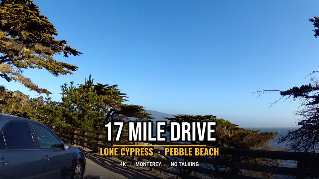
The place where cars now stop to look at the Lone Cypress was first called Midway Point. On the original carriage outing from Hotel Del Monte it marked a rough halfway pause. Coaches halted so passengers could picnic before turning back toward the porch. The stop sat above a granite headland. A single Monterey cypress grew on the rock below the level of the road. Over time the tree became the reason people remembered the stop, and the stop took the name of the tree. The geometry did not change. The rail, the short flight of steps to the lower deck, and the closed path to the trunk are later additions. The rock and the tree were already there when the first parties of coaches paused for lunch in the 1880s.
Early images from that decade show a fuller crown than the tree carries now. Wind and salt have continued to prune it. In 1941 a stone retaining wall was built around the base to limit erosion of the thin soil and the roots that hold the tree to the granite. In 1948 cables were added to support the main limbs. In 1969 the area immediately around the trunk was fenced off to the public. Visitors since then have looked from the upper rail or from the lower wooden deck. They do not walk to the tree. The restrictions were practical. Foot traffic on the shallow soil and exposed roots risked the stability of a tree that had become the most photographed object on the drive.
In 1984 someone set a small fire at the base. The tree survived with minor scarring. On 16 February 2019 a Pineapple Express storm tore away one of the major limbs. The loss changed the outline that had appeared on postcards and in company advertising for decades. The Pebble Beach Company, which owns the land and acts as custodian of the tree, has not attempted to restore the missing limb. The tree continues to stand on the same rock, supported by the wall and the remaining cables, viewed from the same fenced overlook.
The company registered the image of the tree as a trademark. The registration gives it control over commercial uses of the specific silhouette. Photographers who sell pictures of the tree, and businesses that want to use the outline in advertising, are expected to obtain permission. The tree itself is not private property in the ordinary sense. It is a wild Monterey cypress growing on company land inside one of the two native stands of the species. The trademark applies to the image, not to the organism. The distinction matters less to most visitors than the practical result: the tree is maintained, protected from unrestricted access, and presented as the central emblem of the resort that owns the surrounding forest and golf courses.
The shift from Midway Point to the Lone Cypress tracks the larger change in how the drive was used. The original picnic stop belonged to an afternoon outing organized by the hotel. Guests ate, looked at the water, and returned to the porch. Once the route became a paid automobile loop entered at gates, the same overlook turned into the single stop that most people could name without a map. Other pullouts—Spanish Bay, Bird Rock, the Ghost Trees, Crocker Grove—remained on the company’s printed guide. The tree on the rock became the one image that stood for the entire circuit. Its outline appeared on signs, on merchandise, and in the broadcasts of golf tournaments played on the courses that now occupy the adjacent land.
The tree has outlasted the hotel that first sent carriages past it. It has outlasted the porch, the stables, and the specific corporate entities that have held title since 1880. It has also outlasted the limb it lost in 2019. The wall, the cables, and the fence are the visible signs that the present owner treats it as an asset worth preserving. The granite it grows on has not moved. The road that pauses above it is the descendant of the carriage track that first made the tree a regular sight for people who did not live on the peninsula. What changed is the reason the pause is enforced and the legal status of the picture people take when they stop.
Golf, houses, and a private community
In 1919 Samuel F. B. Morse and the Del Monte Properties Company acquired the Pacific Improvement Company’s holdings on the peninsula. Morse had already been involved with the property as an executive. Under the new company the land that had been shown to hotel guests as potential lots became a planned residential and resort community centered on golf. Pebble Beach Golf Links opened the same year. It occupied the shore and the dunes that the earlier carriage drive had passed. Other courses followed over the next decades: Cypress Point, Spyglass Hill, the Links at Spanish Bay, and Poppy Hills among them. The road that had begun as an afternoon outing now ran between fairways, clubhouses, and the fences of private houses.

The modern picnic basket. A hard cooler that keeps ice through a slow daylight circuit, the current version of the pause the hotel coaches once made at Midway Point. See the YETI Roadie 8 on Amazon
Hotel Del Monte continued to operate, but its role changed. The original wooden building had burned in 1887 and been rebuilt. The second hotel burned in 1924. The 1926 replacement was a more substantial structure. During the Second World War the United States government took over the property. After the war it became part of the Naval Postgraduate School and was renamed Herrmann Hall. The porch from which the first carriage parties had departed in 1881 now stands inside a military installation. Visitors to the drive no longer begin or end their circuit there. The hotel that had invented the outing survived only as a repurposed building whose original function had ended.
The community that grew around the golf courses was private by design. Houses were built on the lots the Pacific Improvement Company had assembled from David Jacks’s holdings. Access to the interior roads, including the scenic loop, was controlled at gates. Non-residents paid a fee to enter. The fee has changed over time, as have the rules for bicycles and the precise hours of operation. Motorcycles have been prohibited for decades. The underlying arrangement has remained consistent: the forest, the shore, and the road through them belong to the company that owns the surrounding residential and resort land. Residents and hotel guests move freely. Everyone else enters on the company’s terms.
Ownership of that company has itself changed hands several times since Morse’s era. In the late 1970s it passed to interests connected with 20th Century Fox. It later moved to Japanese ownership under Minoru Isutani and then, in 1999, to a group that included Clint Eastwood, Arnold Palmer, and Peter Ueberroth. Throughout these transfers the basic use of the land stayed the same. The golf courses remained the most visible attractions. The houses continued to occupy the lots first marketed to Hotel Del Monte guests. The scenic road continued to function as the way outsiders could see the result without owning any of it. The Lone Cypress, already the most photographed tree on the circuit, became the registered trademark and the public emblem of the Pebble Beach Company.
The original carriage outing had been a way to show unsold land to people who had arrived by train. By the middle of the twentieth century the land was no longer unsold. It was occupied by a high-end residential community and by golf courses that hosted professional tournaments. The drive survived the transition because it still performed a useful service for the owner. It let paying visitors move slowly through the property, stop at designated overlooks, and leave. The forest interior, the open stretches of water, and the rail above the tree remained the sequence that justified the fee. What had been removed was the starting porch at the hotel and the possibility of treating the road as an ordinary public way between Monterey and Carmel.
The Chinese fishing village at Point Alones had been cleared decades earlier. The smaller camp on the rocks at Stillwater Cove had disappeared even sooner. The land those communities occupied was incorporated into the same private holdings that now contain the golf courses and the houses. The road that once carried hotel guests past the drying racks now carries cars past fairways and gates. The cypress on the granite at the old Midway Point continues to stand inside the boundary of the community that formed around it. The title that began with the post-1848 confirmation of Mexican grants, passed through David Jacks, and was sold to the railroad’s property company in 1880 is still the title that governs who may drive the loop and who may build beside it.
What remains visible from the road
The loop that visitors drive today is a compressed remnant of the 1881 carriage outing. It no longer starts at the porch of Hotel Del Monte. It no longer passes through the streets of Monterey or Pacific Grove as part of the official circuit. It lies almost entirely inside Del Monte Forest, entered and exited at gates controlled by the Pebble Beach Company. The distance is still called seventeen miles. The sequence of forest, water, and overlook remains recognizable. What has been removed is the hotel that invented the drive and the towns that once formed part of the route.
Certain places along the present road still carry earlier layers. The granite headland at the Lone Cypress is the same rock where coaches once paused at Midway Point. The tree that grows on it is the same individual that appears in photographs from the 1880s, though one major limb is now missing and the crown is thinner. The stone wall, the cables, and the fence are twentieth-century additions. The rock and the tree predate them. Crocker Grove preserves a stand of older Monterey cypress a short distance inland from the most exposed shore. The trees there show the denser growth that occurs where wind and salt have less effect. At Pescadero Point the pale trunks of the Ghost Trees mark another stretch of the native stand. One of them is gone. The others remain visible from the pullout.

Water for the full circuit. An insulated tumbler that stays cold through the slow miles between gates, the practical companion for a drive built for looking rather than hurrying. See the Stanley IceFlow Tumbler on Amazon
The shore that once held the small Chinese fishing camp at Stillwater Cove is still part of the circuit. The shacks and the drying racks are not. The rocks are now viewed from the road or from the edge of a golf course. No marker identifies the site as a former camp. The larger village at Point Alones, on the waterfront nearer Pacific Grove, lies outside the gated loop entirely. Its location is now occupied by other uses, including the grounds of the Hopkins Marine Station. The families who lived there moved to McAbee Beach after the 1906 fire and eviction. Some of their descendants remained in the Monterey area. The ground they occupied on company land did not remain a fishing village.
The forest itself is the most continuous presence. Monterey cypress and pine grew on these headlands before David Jacks assembled the tracts, before the Pacific Improvement Company bought them, and before the first carriages left the hotel porch. The company and its successors enclosed the forest, improved the roads, and later built houses and golf courses inside it. They did not plant the original trees. The two native stands of Monterey cypress—one inside the present Del Monte Forest and one at Point Lobos—remain the only wild populations of the species. The road lets visitors see portions of the northern stand from designated pullouts. The rest of the forest is private land behind fences and gates.
The contrast between the maintained public viewpoints and the private land around them is the ordinary condition of the drive. At the Lone Cypress the company has built a railing, a lower deck, and a fence that keeps people away from the trunk. Similar overlooks exist at Spanish Bay, Bird Rock, Fanshell Beach, and the Ghost Trees. Between those stops the road runs past houses, fairways, and forest that visitors are not invited to enter. The fee paid at the gate purchases the right to move slowly along the marked route and to stop at the places the company has chosen to present. It does not purchase access to the residential streets or to the clubs. The arrangement is consistent with the original purpose of the outing. The land was shown to outsiders under conditions set by the owner. Those conditions have been updated for automobiles and for a completed residential community, but they have not been reversed.
The tree on the granite has outlasted the hotel porch, the Chinese village at Point Alones, the small camp on the nearby rocks, and every corporate entity that has held title since 1880. It has also outlasted the limb it lost in 2019. The road that pauses above it is the descendant of the carriage track that first made the tree a regular sight for people who did not live on the peninsula. What remains visible from that road is a set of specific survivals: the native cypresses, the granite they grow on, the forest that contains them, and the controlled sequence of overlooks that lets visitors look at those things without entering the private land around them. The title that governs the land began with the confirmation of Mexican grants after 1848, passed through David Jacks, and was sold to the railroad’s property company in 1880. It still determines who may drive the loop and what they are permitted to see when they do.