Profile
As an Amazon Associate I earn from qualifying purchases.
Section 1: Indigenous trails and the lowest gap
Cahuenga Pass sits at roughly 745 feet above sea level, the lowest practical crossing of the Santa Monica Mountains between the Los Angeles Basin and the San Fernando Valley. For thousands of years before any European arrived, this modest gap served as a natural corridor for the people who lived on both sides of the range. The Tongva (also known in Spanish and later anthropological sources as Gabrielino or Gabrieleño) maintained villages across the basin and into the Valley. One of those settlements, recorded under spellings such as Kawé’nga, Kawee’nga, Kaweenga, or Cabuenga, stood near the northern mouth of the pass, in the vicinity of what is now Universal City and Studio City. The name itself is usually translated as “place of the mountain” or “place of the hill,” though more recent linguistic work has also offered “place of the fox.” The Tongva suffix -nga marks a place, and the related form -bet or -bit marked a person from that place; mission registers later listed individuals associated with the village as Capuebet or similar variants.
The pass was not a barrier. It was the easiest route connecting the two landscapes. On the basin side the terrain drops toward the coastal plain and the Los Angeles River system. On the Valley side it opens into the broad San Fernando plain, with its oak woodland, grasslands, and seasonal watercourses. Foot trails followed the natural contours of the gap, avoiding the higher ridges of the Santa Monica Mountains that rise sharply on either side. Those ridges forced anyone traveling between the two regions either through this low saddle or around the mountains entirely. Over generations the path through the pass became a regular route for movement, exchange, and seasonal use.
People associated with the village appear in the earliest Spanish mission records. The first baptism linked to Cahuenga is dated 1798. Between 1778 and 1815, individuals connected with the name appear roughly twenty times in the San Gabriel Mission registers; between 1800 and 1806 they appear more than sixty times in the San Fernando Mission registers. Three people identified with Capubet or Cahuenga were also baptized in the Pueblo of Los Angeles. These counts indicate an established community whose members moved between the Valley, the basin, and the missions once Spanish authority arrived. The precise location of the village itself has never been fixed by archaeology; the area around Campo de Cahuenga is the traditional identification, but no single excavated site has been confirmed as the ethnographic village center.
The landscape the Tongva used looked different from the freeway corridor that occupies the pass today. Hillsides were more open, covered in native grasses, coastal sage scrub, and scattered oaks. The Los Angeles River had once flowed through the pass in a much earlier geologic period before uplift of the Santa Monica Mountains diverted it eastward around the Verdugo Mountains and Griffith Park. Seasonal streams still drained the gap. The trail itself was simply the worn path that followed the lowest continuous grade. Travelers on foot could move from the basin to the Valley in a few hours under ordinary conditions. The same route later became the line of the wagon road, the Pacific Electric tracks, and eventually the Hollywood Freeway, but for the long period before any of those improvements the pass remained a foot corridor.
Spanish explorers and later settlers adopted the indigenous name, rendering it Cahuenga. Gaspar de Portolá’s expedition crossed the area in 1769 and noted the valley beyond, but the pass itself was already a known and used feature of the indigenous landscape. Once Mission San Gabriel (1771) and Mission San Fernando (1797) were established, the corridor continued to carry people between the two mission spheres. After Mexican independence and the secularization of the missions, the name attached itself to land grants, to the adobe ranch house that later became Campo de Cahuenga, and to the two small armed confrontations that occurred on the Valley side of the pass in 1831 and 1845. Those later events sit outside the indigenous period, yet they took place on the same ground that had already been a recognized crossing for centuries.
What the indigenous record shows is continuity of use rather than a single dramatic moment. The pass was the lowest and therefore the most practical gap. A village sat near its northern end. Trails ran through it long enough that the Spanish found an established route and an established place name when they arrived. The elevation of 745 feet is modest by mountain standards, but it was low enough, and the approaches gradual enough, that it remained the preferred corridor even after horses, wagons, and later mechanical transport replaced foot travel. Every subsequent road through the pass has followed, more or less, the line that the original trail already occupied.
The same geographic fact still governs the route. The Santa Monica Mountains continue to rise on both sides of the gap. No lower continuous crossing exists between the basin and the Valley. The modern freeway and the older surface boulevard occupy the identical saddle that indigenous travelers used. The name that survives on the freeway signs, the boulevard, and the historic site is the one the Tongva applied to the place of the mountain.
Section 2: Spanish and Mexican crossings and the first wagon road
Gaspar de Portolá’s expedition of 1769 was the first European party known to cross from the Los Angeles Basin into the San Fernando Valley through the Cahuenga gap. The Spanish recorded the valley beyond as the Valley of the Oaks and treated the pass itself as an existing route rather than a discovery. The foot trail that indigenous people had already worn through the lowest saddle became, under Spanish administration, part of the larger north–south corridor that linked the missions of Alta California. Mission San Gabriel was founded in 1771; Mission San Fernando Rey de España followed in 1797. Traffic between the two missions, and between the missions and the pueblo of Los Angeles, moved through the same gap. The route also carried herds of cattle and horses as the missions established grazing rights on the Valley side.
After Mexican independence in 1821 the missions were secularized and the surrounding lands were granted as ranchos. Several grants framed the approaches to the pass. On the Valley side, the small Rancho Cahuenga (roughly 388 acres) was granted in 1843 by Governor Manuel Micheltorena to José Miguel Triunfo, a former Mission San Fernando Indian. Nearby grants included portions of Rancho Providencia and lands associated with the Verdugo family. An adobe ranch house stood near the northern mouth of the pass, on ground that later became known as Campo de Cahuenga. The precise date of the original structure is uncertain, but by the 1840s it was already described as old and was used for storage and seasonal occupancy. The name Cahuenga attached itself both to the pass and to these land holdings, carrying the indigenous place-name forward into the Mexican period.
The trail remained a narrow, steep path until the early 1850s. In 1828 a traveler described the “glen of Cow-wanga” as an “indescribable mountain road.” Cattle and sheep were driven across it, but wheeled vehicles found the grade difficult. By 1852 a wagon road had been constructed through the pass, replacing the earlier foot and pack trail with a route that ox-carts, mule teams, and stagecoaches could use. The improvement was modest by later standards: the road stayed unpaved, narrow, and steep, following the natural contours of the gap rather than cutting deeply into the hillsides. It was still the only practical wheeled crossing between the basin and the Valley.
Two armed confrontations occurred on the Valley side of the pass during the Mexican period. The first, on 5 December 1831, pitted the unpopular Governor Manuel Victoria against a force assembled by local landowners and supporters of the previous governor, José María de Echeandía. Victoria had ordered the execution of José Antonio Carrillo and Abel Stearns, then stayed the sentences and banished them. The rebels occupied Los Angeles; Victoria marched to meet them near the mouth of the pass. Accounts describe a brief fight in which two men were killed—José María Ávila on the rebel side and José Romualdo Pacheco on the government side—and Victoria himself was wounded by a lance. Victoria resigned shortly afterward. The second engagement, known as the Battle of Providencia or the Second Battle of Cahuenga Pass, took place on 20 February 1845 on the plains just north of the pass, near present-day Burbank. Governor Manuel Micheltorena, leading a force that included convict soldiers, faced Californio rebels under José Castro, Juan Bautista Alvarado, and Pío Pico. The two sides exchanged artillery fire across a wide field. Casualties were limited to a single horse or mule. Micheltorena withdrew, left California, and was replaced by Pío Pico as governor. Cannonballs from these actions have continued to surface during later excavations in the area.
The most consequential event at the northern end of the pass occurred two years later. After U.S. forces reoccupied Los Angeles in January 1847, Californio commander Andrés Pico and Lieutenant Colonel John C. Frémont met at the adobe ranch house of Campo de Cahuenga. On 13 January 1847 they signed the Articles of Capitulation, also called the Treaty or Capitulation of Cahuenga. The document, drafted in both Spanish and English by José Antonio Carrillo, required the Californios to surrender their artillery and public arms, to return peaceably to their homes, and not to take up arms again during the war, in exchange for the same rights enjoyed by citizens of the United States. The agreement was made without formal authorization from either Mexico City or Washington, yet both sides later honored it. Hostilities in California effectively ended. The larger Treaty of Guadalupe Hidalgo, signed the following year, confirmed the transfer of Alta California to the United States.
The 1852 wagon road and the events of 1831, 1845, and 1847 all took place on the same low saddle that indigenous travelers had used for centuries. The Spanish and Mexican periods added land grants, a formal wagon grade, two small battles, and the site of the capitulation that closed the Mexican–American War in California. The physical alignment of the crossing itself changed very little until the twentieth century. The steep, unpaved wagon road of 1852 remained the principal route through the pass for decades afterward, carrying stages, freighters, and later early automobiles until the Pacific Electric tracks and, eventually, the freeway occupied the identical gap.

Reliable power for the road. The Jackery Explorer 300 packs 292Wh of LiFePO4 capacity into a 7.5-pound package with pure sine wave AC outlets, making it a solid companion for road trips, camping stops, or blackout backup along routes like the 101. See the Jackery Explorer 300 on Amazon
Section 3: Butterfield stages, El Camino Real, and the Pass Hotel
The Cahuenga Pass formed part of the historic El Camino Real, the chain of roads that linked the Franciscan missions of Alta California from San Diego to Sonoma. Spanish and later Mexican travelers already used the low gap as the practical route between the Los Angeles Basin and the San Fernando Valley. After the American occupation the same alignment continued to carry freight wagons, personal carriages, and livestock between the pueblo and the ranchos and mission lands to the north. A marker still stands along Cahuenga Boulevard that identifies the area as Paseo de Cahuenga, recalling that older designation.
The Butterfield Overland Mail brought regular scheduled stage service through the pass beginning in 1858. John Butterfield’s company held the federal contract to carry mail and passengers between St. Louis / Memphis and San Francisco on the southern “oxbow” route. In California the line ran from Fort Yuma through Los Angeles and then northward. Cahuenga Station was listed as a stop roughly twelve miles northwest of Los Angeles and twelve miles southeast of Mission San Fernando. Stages changed teams or paused for passengers and mail at this point before continuing through the San Fernando Valley toward the San Fernando Pass and Fort Tejon. The service operated twice weekly in each direction and required the mail to complete the full transcontinental trip in twenty-five days. Butterfield stages used the Cahuenga crossing until the southern route was discontinued at the outbreak of the Civil War in 1861 and the mail contract was shifted to a more central overland path. For those three years the pass was part of the longest regularly scheduled horse-drawn mail and passenger route in the United States.
Even after the Butterfield stages left, the road through the pass remained narrow, steep, and unpaved for decades. Travelers in the 1850s and 1860s described a winding grade that followed the natural contours of the gap rather than a heavily engineered cut. Hillsides stayed relatively open, covered in native grasses, coastal sage, and scattered oaks, with only occasional eucalyptus plantings near the summit. Freight teams, ranchers moving stock, and local residents continued to use the crossing. Photographs from the 1880s and 1890s still show a modest dirt road, open slopes, and little permanent development beyond a few structures at the summit.
The best-known of those structures was the Eight Mile House, also called the Cahuenga Tavern or Pass Hotel. Most local accounts place its construction in the early 1870s, though some references suggest a precursor establishment existed by the late 1850s. The name “Eight Mile House” referred to its approximate distance by the old road from the center of Los Angeles. The building was a two-story wooden structure set among tall eucalyptus trees near the summit of the pass. It served as tavern, hotel, store, and occasional toll or way station for stage drivers, freighters, ranchers, and other travelers moving between the basin and the Valley. Food, drink, lodging, and basic supplies were available. For several decades it was a familiar landmark on the route; photographs from 1882 show the tavern nestled among the trees at the top of the grade. Its importance declined once faster and more reliable transportation—first the Pacific Electric tracks, later improved automobile roads—reduced the need for an overnight stop in the pass itself.
The rustic character of the crossing persisted well into the early twentieth century. As late as 1914, filmmaker Cecil B. DeMille kept a small wooden cabin in the pass and rode a horse into his studio each day, carrying a revolver on his hip. Contemporary accounts and photographs from the first decade of the 1900s still depict open hillsides, a modest wagon or early auto road, and only scattered buildings. Campers and picnickers used the oak-dotted slopes. The pass had not yet been widened into a multi-lane highway or cut for freeway construction. The combination of the Butterfield stage era, the long-lived Pass Hotel, and the still-open landscape of the late nineteenth and early twentieth centuries marks the period when Cahuenga remained a rural mountain crossing rather than an urban freeway corridor. The Eight Mile House and the stage station it succeeded are gone, but the alignment they served is the same low gap that continues to carry the modern route.

High-output power that travels light. The Anker Prime 26,250mAh power bank delivers up to 300W total output and TSA-approved capacity, ideal for keeping laptops, phones, and cameras charged during long drives or stops along the 101. See the Anker Prime Power Bank on Amazon
Section 4: Pacific Electric reaches the Valley
In 1911 the Pacific Electric Railway completed its San Fernando Valley line through the Cahuenga Pass, bringing electric interurban service from Los Angeles into the Valley for the first time. The first Red Car reached Van Nuys on 16 December 1911. A year later the line was extended westward to Owensmouth (later Canoga Park), and by 1913 a branch reached San Fernando. The tracks followed the existing low corridor through the pass, initially on a private right-of-way alongside the wagon road and early automobile route. Construction photographs from January 1911 show crews laying rail along the hillside while horse-drawn wagons still used the dirt road below. The opening connected the growing Valley communities directly to Hollywood and, via transfer, to downtown Los Angeles.
From the outset the line shared the pass corridor with automobiles. Early automobiles and the electric trains operated side by side or on parallel alignments. The Red Cars carried a mix of riders that reflected the Valley’s changing character: weekday commuters traveling to jobs in Los Angeles and Hollywood, Saturday passengers heading to the movie theaters of Hollywood, and weekend families making outings to the beach or to other points on the larger Pacific Electric network. By 1917 most Valley residents could reach Hollywood in about thirty-one minutes over the Cahuenga line and continue from there into downtown. Ridership grew with the Valley itself. More than 368,000 passengers used the line in 1913; by 1926 the figure exceeded one million. A network of roughly three dozen stations dotted the route, providing frequent and inexpensive service that subdividers used as a selling point for new residential tracts.
In 1925–1926 the Pacific Electric opened the Hollywood Subway (officially the Belmont Tunnel), a mile-long double-track tunnel that ran beneath Bunker Hill from a portal near Beverly Boulevard and Glendale Boulevard to the new Subway Terminal Building at Fourth and Hill Streets in downtown Los Angeles. The terminal, designed in Italian Renaissance Revival style, sat above the underground station and also housed offices. Beginning in early 1926 the San Fernando Valley and Hollywood lines were routed into the Subway Terminal, eliminating the need for trains to crawl through the congested surface streets of downtown. The tunnel shortened travel times by ten to fifteen minutes and, at its peak during World War II, handled tens of thousands of passengers daily. Valley cars departed the Subway Terminal, ran through the tunnel, and continued through Hollywood and the Cahuenga Pass before branching across the Valley. The arrangement gave the line a direct, grade-separated entrance into the central business district.
Service patterns evolved as the Valley developed and as automobile ownership rose. In the late 1930s the outer portions of the line were cut back. Through service to Owensmouth/Canoga Park and to San Fernando ended on 1 June 1938; thereafter the regular terminus was at Van Nuys Boulevard and Sherman Way. The core run through the Cahuenga Pass to Van Nuys continued. When the Cahuenga Pass Freeway opened in 1940, the Pacific Electric tracks were relocated into the center median of the new eight-lane road, creating the unusual sight of Red Cars running between opposing streams of freeway traffic. That median arrangement lasted until the early 1950s.
The San Fernando Valley line operated for just over forty years. The last regularly scheduled Red Car through the pass to Van Nuys ran on 28 December 1952. Buses replaced the trains. In 1953 the tracks, overhead wire, and stations in the median were removed and the space was paved into additional freeway lanes. The Hollywood Subway and Subway Terminal continued to serve other lines until 1955. The physical corridor through the pass, however, had already shifted from a shared rail-and-road alignment to a pure freeway once the rails were gone.
For the decades it operated, the Pacific Electric line made the lowest gap in the Santa Monica Mountains a dual-mode corridor. Electric trains and early automobiles used the same natural saddle that indigenous foot traffic, wagon roads, and Butterfield stages had already occupied. The 1911 opening, the 1926 subway connection, the 1940 median placement, and the 1952 abandonment mark the full arc of interurban rail through the pass. The Red Cars did not invent the route; they occupied, for one generation, the same low crossing that every previous and subsequent form of transport has also used.

Bright light for early starts and late arrivals. The Fenix PD40R V3.0 throws 3000 lumens out to 547 yards with a mechanical rotary switch and USB-C charging, useful for roadside checks or exploring historic spots along the old Cahuenga corridor. See the Fenix PD40R on Amazon
Section 5: The 1940 Cahuenga Pass Freeway with tracks in the median
On 15 June 1940 the Cahuenga Pass Freeway opened to traffic, the first completed segment of what would become the Hollywood Freeway. The roughly two-mile stretch replaced the narrow, winding surface road through the lowest gap in the Santa Monica Mountains with an eight-lane limited-access highway—four twelve-foot lanes in each direction. Pacific Electric tracks occupied the center median, separating the opposing streams of automobiles. Service roads ran along both sides. The design was presented as forward-looking: cars and electric rail sharing a modern highway corridor. Photographs from the opening show the tracks sitting cleanly between the new concrete lanes, with the Mulholland Drive and Pilgrimage (later John Anson Ford) bridges overhead. A short tunnel near the southern end carried some southbound traffic under the tracks toward Highland Avenue.
The project was partly financed by the Public Works Administration. Federal funds covered a substantial share of the roughly $1.5 million cost; the State of California, the City of Los Angeles, and Los Angeles County supplied the balance. Contractors worked under a compressed schedule, at times around the clock, to finish the first unit. The freeway ran from near Barham Boulevard on the Valley side to the vicinity of Mulholland Drive on the Hollywood side, eliminating a long-standing bottleneck where the old El Camino Real alignment crossed the mountains. Daily traffic on the previous road had already reached 45,000 to 50,000 vehicles.
Dedication ceremonies took place on opening day. Los Angeles Mayor Fletcher Bowron, California Governor Culbert L. Olson, and Public Works Administration Regional Director K. A. Godwin led the proceedings. Other participants included State Highway Commissioner Amerigo Bozzani, John B. Kingsley of the Hollywood Chamber of Commerce, and several honorary mayors of Valley communities, among them Gene Autry of North Hollywood. A luncheon followed at the Hollywood Bowl. Contemporary accounts describe a procession that recalled earlier forms of travel through the pass—horses, stagecoaches, and antique automobiles—before the new roadway was formally opened. The event received national attention as an example of integrating rail rapid transit into new highway construction.
The arrangement was unusual even in 1940. Pacific Electric management had advocated placing tracks in the medians of planned freeways, and the Cahuenga Pass segment was the one place where that idea was realized. Red Cars continued to run through the median to Van Nuys while automobiles used the outer lanes. The visual result—electric trains traveling between opposing freeway traffic beneath the Mulholland and Pilgrimage bridges—was photographed repeatedly in the years after the opening. The design allowed the existing rail service to remain while providing a modern highway connection through the pass. It lasted twelve years.
The 1940 freeway was only the first piece of a longer project. Plans for a continuous “stop-free express highway” between downtown Los Angeles and the San Fernando Valley dated to a 1924 bond measure. Wartime shortages delayed the remaining sections. The full Hollywood Freeway from downtown to the Valley opened in stages and was considered complete in 1954. North of the pass the route transitioned onto the Ventura Freeway. The 1940 Cahuenga Pass segment, however, retained its distinctive character until the end of rail service. On 28 December 1952 the last regularly scheduled Red Car ran the Valley line. The following year the tracks, overhead wire, and stations in the median were removed and the space was paved into additional lanes. Some of the bolts that once held the trolley wire remained visible for years on the Barham Boulevard bridge.
The 1940 opening marked the moment when the lowest gap in the Santa Monica Mountains became a limited-access freeway while still carrying electric rail. The eight-lane road with center tracks, the PWA financing, the dedication attended by city and state officials and local celebrities, and the overhead bridges together created a short-lived hybrid corridor. Photographs from 1940 and the early 1950s preserve the image of Red Cars running down the middle of what was then one of the region’s newest freeways. Once the tracks were gone, the same concrete alignment continued as ordinary freeway, but the 1940 design remains the clearest physical record of the period when automobiles and Pacific Electric trains shared the Cahuenga Pass.

Capture the drive hands-free. Meta Oakley Vanguard AI glasses combine Prizm lenses with a 12MP camera, open-ear audio, and Meta AI so you can record road scenery or get quick answers without taking your hands off the wheel. See the Meta Oakley Vanguard on Amazon
Section 6: Last Red Car and the removal of the tracks
The final regularly scheduled Pacific Electric Red Car on the San Fernando Valley line ran through the Cahuenga Pass on 28 December 1952. Car 5138 left the Subway Terminal in downtown Los Angeles in the early morning hours and made the last regular trip to Van Nuys. Dignitaries and longtime riders joined the final run. Cowboy performer Montie Montana, then honorary sheriff of the Valley, later recalled it as a sad day. After more than forty years of electric service, buses replaced the trains. The change ended the hybrid corridor that had existed since 1940, when the eight-lane Cahuenga Pass Freeway opened with Pacific Electric tracks occupying the center median.
Replacement bus service did not begin immediately. Delays at a General Motors production facility postponed the start of regular bus operations through the pass until late May 1953. In the meantime the tracks remained in place, unused for passenger service. During 1953 crews removed the rails, overhead wire, and the small stations that had stood in the median. Photographs from that year show the long scar where the tracks had run, with poles still standing, ballast disturbed, and construction equipment working while automobiles continued on the outer lanes. The median, roughly forty-eight feet wide, was then paved and incorporated into the freeway as additional traffic lanes. The conversion turned the 1940 design—cars and rail sharing the same limited-access road—into a conventional multi-lane freeway.
Physical traces of the rail era remained visible for years. The bolts that had held the trolley wire were still present on the Barham Boulevard bridge long after the tracks themselves were gone. Contemporary accounts and later photographs noted these remnants. The short southern tunnel that had once carried some southbound traffic under the tracks toward Highland Avenue was also altered or closed as the freeway was widened and reconfigured. The bridges built in 1940—Mulholland Drive, the Pilgrimage (John Anson Ford) Theatre bridge, and Barham Boulevard—continued to span the widened roadway, but the center space they once crossed over rail now carried only automobiles.
The abandonment was part of a larger contraction of the Pacific Electric system. Outer segments of the Valley line had already been cut back in 1938. Other major lines elsewhere in Southern California were converted to buses in the late 1940s and early 1950s. Pacific Electric’s passenger operations were sold in 1953; the last Red Car anywhere on the system ran in 1961. In the Cahuenga Pass the change was especially visible because the tracks had occupied the median of a modern freeway rather than a private right-of-way or city street. Once the rails were removed, the pass lost the last regular rail service that had used the lowest gap in the Santa Monica Mountains since 1911.
A different rail line returned to the corridor decades later. The Metro Red Line (now B Line) subway opened under the pass to Universal City in 2000, running in a new tunnel rather than on the surface alignment the Red Cars had used. The 1952–1953 removal therefore marked a clean break: the end of the surface electric railway that had shared the 1940 freeway, the conversion of its median into additional lanes, and the disappearance of the most distinctive feature of the original Cahuenga Pass Freeway. The bolts on the Barham Boulevard bridge and the photographs of track removal remain the principal physical and visual records of the twelve years when Red Cars ran down the middle of the Hollywood Freeway.

Ice that lasts the full drive. The YETI Roadie 8 hard cooler keeps drinks cold with Permafrost insulation and a one-hand latch, sized for 12 cans and built for the back seat or boat on longer 101 runs. See the YETI Roadie 8 on Amazon
Section 7: Completing the Hollywood Freeway to downtown
The 1940 Cahuenga Pass Freeway was only the first segment of a longer route that Los Angeles voters had authorized in principle in 1924. That year’s bond measure approved a “stop-free express highway” between downtown Los Angeles and the San Fernando Valley. World War II shortages of labor and materials halted further construction after the pass segment opened. Work resumed in the late 1940s. The Collier-Burns Act of 1947 assured state highway funding, and excavation began in the civic center area. The full ten-mile Hollywood Freeway from the Valley to downtown opened in stages between the late 1940s and April 1954 at a total cost of about $55 million.
Construction proceeded from both ends. A section beyond the pass toward Vineland Avenue opened in 1949. Segments through Hollywood and toward downtown followed. The final link, connecting Hollywood Boulevard to the Mulholland Bridge area, opened with a ribbon-cutting on 15 April 1954; Bob Hope officiated at one of the ceremonies. The completed freeway ran from Vineland Avenue in the San Fernando Valley to Spring Street in the Los Angeles civic center. It included the downtown “slot” and connected with the Four-Level Interchange, the multi-level junction with the Harbor, Arroyo Seco, and Santa Ana freeways that had been completed earlier. That interchange alone cost roughly $5.5 million and required the removal of a large portion of Fort Moore Hill.
Building the freeway through an already developed urban area required extensive right-of-way acquisition. Across the roughly six and a half miles between Spring Street and the Cahuenga Pass, crews relocated approximately 1,728 buildings and demolished another 90. The structures included residences, apartment buildings, stores, and other commercial properties. In Whitley Heights the path took Rudolph Valentino’s former home and other houses. Charlie Chaplin’s former residence was also among the properties affected. Engineers routed the freeway around certain landmarks, including the First Presbyterian Church of Hollywood, the Hollywood Tower apartments, and the KTTV studio, and planted landscaping near the Hollywood Bowl to reduce noise. In other places the alignment cut more directly: it bisected Echo Park, separating the lake from adjacent parkland, and carved through downtown, eliminating the old Fort Moore Hill high school site and displacing thousands of residents near the Four-Level Interchange. Much of the rubble from demolished buildings was dumped into Chávez Ravine.
Traffic filled the new road almost immediately. A year after the full freeway opened, average daily volumes reached about 183,000 vehicles—nearly double the volume for which the road had been designed. Bob Hope incorporated the congestion into his routine, calling the Hollywood Freeway the “biggest parking lot in the world.” One section between Vermont Avenue and the Four-Level Interchange was already described in 1954 as carrying 168,000 vehicles a day, the most heavily traveled traffic arterial in the world at the time. The rapid overload reflected both the postwar growth of the San Fernando Valley and the broader shift of Los Angeles travel onto freeways. The original design capacity assumptions, based on prewar and immediate postwar projections, proved inadequate within months of the road’s completion.
The 1954 opening completed the continuous limited-access route that the 1924 plan had envisioned and that the 1940 Cahuenga Pass segment had begun. It also marked the first time a major Los Angeles freeway had been built through a densely populated residential and commercial district on this scale. The combination of wartime delay, staged postwar construction, the large number of buildings moved or demolished, the $55 million cost, and the immediate surge of traffic beyond design capacity defines the completion of the Hollywood Freeway. The corridor that indigenous trails, wagon roads, Butterfield stages, and Pacific Electric trains had all used through the lowest gap in the Santa Monica Mountains was now a continuous modern freeway from the Valley to downtown, already operating well above the volumes its planners had expected.
Section 8: North of the pass: Ventura Freeway and the Valley approach
North of the Cahuenga Pass the Hollywood Freeway meets the Ventura Freeway at the junction known as the Hollywood Split. At this point U.S. Route 101 continues westward as the Ventura Freeway along the southern edge of the San Fernando Valley, while the Hollywood Freeway designation continues northward as State Route 170. The interchange itself developed in stages. The original 1940 Cahuenga Pass Freeway ended near Barham Boulevard; an extension northward toward Vineland Avenue opened in 1949. Full connection into the continuous Ventura Freeway corridor came later, in the late 1950s and early 1960s, as the Valley segment of U.S. 101 was built in pieces and opened progressively between 1958 and 1960. By the early 1960s a continuous freeway route carried U.S. 101 from the Hollywood Freeway westward across the Valley floor toward the western end of the Valley and beyond.
The land immediately north of the pass has long been shaped by the film industry and by residential subdivision. Universal Studios was established near the northern mouth of the pass in 1912 when Carl Laemmle’s company moved operations from Hollywood to leased and later purchased ranch property along Lankershim Boulevard. The studio’s location placed a major production facility directly beside the transportation corridor that already carried the Pacific Electric line and the old wagon road. Studio City developed nearby in the late 1920s. Mack Sennett built a studio at what is now the Radford Studio Center near Ventura Boulevard and Laurel Canyon Boulevard, and the surrounding area was subdivided for residential use. Both communities grew in tandem with improved access through the pass. The 1911 arrival of the Red Cars, the 1940 opening of the Cahuenga Pass Freeway, and the later completion of the Ventura Freeway each accelerated development on the Valley side of the gap.
The alignment north of the pass continues the same low corridor that earlier forms of travel had used. Before the freeways, the road through the northern end of the pass connected to Lankershim Boulevard and Ventura Boulevard, the principal surface routes across the southeastern Valley. Pacific Electric tracks followed a similar path before branching toward Van Nuys, Canoga Park, and San Fernando. When the Hollywood Freeway was extended north of the pass and linked to the Ventura Freeway, the new limited-access road largely followed the same general direction that the earlier surface roads and rail lines had already established. The result is a continuous modern freeway that descends from the 745-foot summit of the pass onto the Valley floor and then runs westward along the southern rim of the Valley, past Studio City, Sherman Oaks, Encino, and Woodland Hills, before continuing into Ventura County.
West of the Hollywood Split the Ventura Freeway carries the bulk of long-distance traffic that has already crossed the Cahuenga Pass. The route was designated part of El Camino Real in 1959 and forms the principal east-west (though signed north-south) highway through the southern San Fernando Valley. Construction of this Valley segment displaced some residential and commercial property, but the scale of relocation was smaller than the large number of buildings moved or demolished during construction of the Hollywood Freeway through central Hollywood and downtown. Once open, the Ventura Freeway quickly became one of the region’s busiest corridors, carrying both local Valley traffic and through traffic bound for the Conejo Valley, Ventura, and points farther north along U.S. 101.
The northern approach to the pass therefore completes the historical corridor that begins in the Los Angeles Basin, climbs the lowest gap in the Santa Monica Mountains, and emerges onto the San Fernando Valley floor. Universal City and Studio City occupy the immediate northern portal; the Hollywood Split organizes the transition onto the Ventura Freeway; and the continuing alignment of U.S. 101 carries traffic westward across the Valley toward the communities that developed along the same general route once used by wagon roads and interurban trains. The freeways of the mid-twentieth century did not invent a new path north of the pass; they formalized, widened, and grade-separated the corridor that indigenous trails, Spanish and Mexican roads, Butterfield stages, and Pacific Electric cars had already followed through the gap and onto the Valley.

Cold drinks that stay cold. The Stanley IceFlow 30 oz tumbler keeps beverages iced for days with double-wall vacuum insulation, a flip straw, and an easy-carry handle—perfect for long stretches of the 101. See the Stanley IceFlow on Amazon
Section 9: Metro B Line under the pass
Nearly half a century after the last Pacific Electric Red Car ran through the Cahuenga Pass, regular rail transit returned to the corridor in the form of a subway. On 24 June 2000 the Los Angeles Metro Red Line (now the B Line) opened its final segment from Hollywood/Vine to North Hollywood. The extension included a station at Universal City/Studio City, located under Lankershim Boulevard near the northern mouth of the pass. The new line placed underground rapid transit beneath the same low gap that indigenous trails, wagon roads, Butterfield stages, Pacific Electric tracks, and the Hollywood Freeway had already occupied on the surface.
Construction of the Valley extension formed part of Minimum Operable Segment 3 of the original Red Line project. Earlier segments had opened from Union Station to Westlake/MacArthur Park in 1993 and from Wilshire/Vermont to Hollywood/Vine in 1999. The final 6.3-mile portion through the Hollywood Hills and under the Cahuenga Pass area was completed on schedule and under budget, in contrast to earlier segments that had experienced cost overruns and construction difficulties. The entire Red Line from Union Station to North Hollywood cost roughly $4.5 billion, with the Valley extension accounting for approximately $1.3 billion. The Universal City/Studio City station was built as an underground facility after local opposition led planners to abandon an earlier elevated concept. The station sits near the historic Campo de Cahuenga, the site associated with the 1847 Treaty of Cahuenga, and serves the Universal Studios complex, Universal CityWalk, and surrounding residential and commercial areas in Studio City and Universal City.
The subway alignment does not follow the exact path of the old Pacific Electric tracks that once ran in the median of the 1940 freeway. Instead, the modern tunnel passes through the bedrock of the Santa Monica Mountains and the Hollywood Hills, emerging in the Valley at Universal City and continuing a short distance to the North Hollywood terminus. Travel time from Hollywood/Highland or Hollywood/Vine to Universal City is only a few minutes. The underground route bypasses the surface congestion that had characterized the pass since the early twentieth century. After the Red Cars stopped in 1952 and the tracks were removed in 1953, the corridor had carried only automobiles and buses for nearly five decades. The 2000 opening restored a direct rail connection between the San Fernando Valley and Hollywood and downtown Los Angeles.
Ridership and traffic effects developed gradually. Metro officials initially projected rapid growth, but actual boardings built more slowly than early forecasts. The line nevertheless provided an alternative for commuters, students, and visitors who previously had no choice but to drive or take buses over the pass. Caltrans data later indicated that traffic growth on the 101 Freeway through the Cahuenga Pass was lower in the decade after the subway opened than on most other freeways in the county. The subway also connected with the Metro G Line busway at North Hollywood, extending the reach of the system farther into the Valley. Subsequent improvements have included better pedestrian connections between the Universal City station and the studio and CityWalk complex.
The return of rail under the pass completed a long cycle. Surface electric trains had shared the gap from 1911 to 1952. For the next forty-eight years the lowest saddle in the Santa Monica Mountains carried only road traffic. The 2000 opening of the B Line placed a modern heavy-rail subway in a new tunnel beneath the same corridor. The station at Universal City/Studio City sits at the northern portal of the historic crossing, near the site of earlier land grants, battles, and the Campo de Cahuenga. The B Line does not restore the Pacific Electric median tracks, but it reestablishes regular rail service through the pass that every previous generation of transport—from indigenous footpaths to the 1940 freeway—had already used.
Section 10: Continuity of the lowest gap
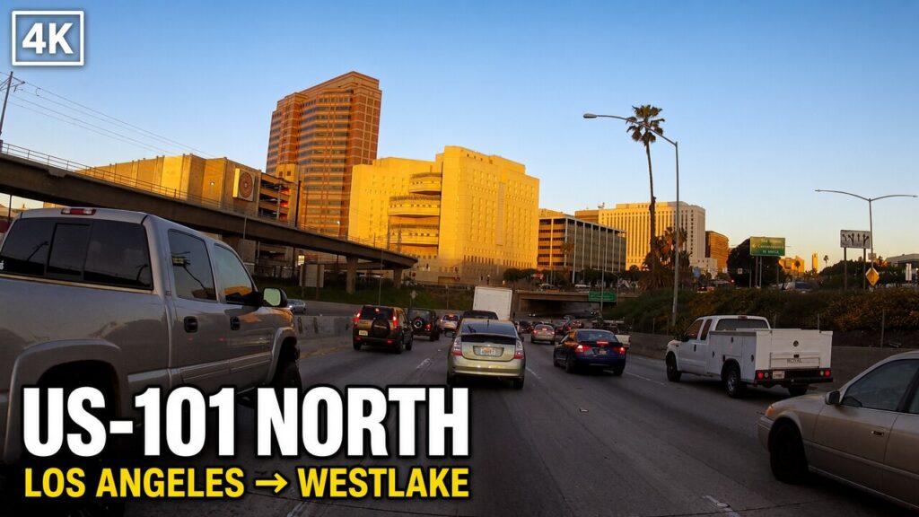
The Cahuenga Pass has remained the lowest practical crossing of the eastern Santa Monica Mountains for as long as people have moved between the Los Angeles Basin and the San Fernando Valley. At roughly 745 feet, the gap sits well below the higher saddles and ridges on either side. That single topographic fact has organized travel through the area for centuries. Indigenous Tongva trails followed the saddle because it required the least climbing. Spanish and Mexican roads used the same low route. Butterfield Overland Mail stages stopped near the summit in the late 1850s. A wooden tavern known as the Eight Mile House or Pass Hotel stood among eucalyptus trees at the top of the grade in the 1870s and later. Pacific Electric tracks reached the Valley through the pass in 1911. The 1940 Cahuenga Pass Freeway placed eight lanes of automobile traffic around those same tracks. The completed Hollywood Freeway extended the limited-access road south to downtown in 1954. After the Red Cars stopped in 1952 and the tracks were removed, the surface corridor continued as ordinary freeway. In 2000 the Metro B Line subway opened in a new tunnel under the hills, restoring regular rail service to the same general alignment. Each successive form of transport has occupied the identical low gap.
The continuity is geographic rather than technological. The pass is not the only possible route between basin and Valley, but it is the easiest. Higher crossings exist farther west and east, yet they demand steeper grades or longer detours. For foot traffic, horse-drawn wagons, stagecoaches, electric interurban trains, and modern automobiles, the lowest saddle has consistently been the preferred path. The name itself records the older use: Cahuenga derives from the Tongva village of Kawé’nga near the northern end of the pass. Spanish speakers adopted the place-name and applied it to the gap they also crossed. American surveyors, railroad engineers, and highway planners inherited the same corridor. When the Pacific Electric built its San Fernando Valley line, it followed the existing low route rather than cutting a new one. When highway engineers designed the 1940 freeway, they widened and grade-separated the alignment already in use. When Metro built the B Line, the tunnel was driven through the same hills that the surface roads and tracks had already followed. The technology changed; the saddle did not.
Physical layers of earlier use remain visible or documented. A marker along Cahuenga Boulevard still identifies the area as Paseo de Cahuenga, recalling the Spanish and Mexican designation of the route as part of El Camino Real. The Campo de Cahuenga, near the northern mouth of the pass, marks the site associated with the 1847 treaty that ended hostilities between American and Mexican forces in California. Photographs from the 1880s show the Pass Hotel among the trees at the summit. Images from 1911 record the laying of Pacific Electric track beside the old wagon road. Photographs from 1940 capture the new eight-lane freeway with Red Car tracks in the median beneath the Mulholland Drive and Pilgrimage bridges. Later images show the tracks being removed in 1953 and the median paved for additional lanes. The Metro B Line station at Universal City/Studio City sits near the historic Campo de Cahuenga and the northern portal of the same gap. Each layer sits on or under the preceding one.
The modern U.S. 101 through the pass therefore carries more than contemporary traffic. It follows the same low saddle that Tongva travelers used, that Spanish and Mexican roads followed, that Butterfield stages crossed, that Pacific Electric trains shared with early automobiles, and that the 1940 freeway formalized as a limited-access road. The subway beneath it returns rail service to the corridor after nearly fifty years of surface-only use. The continuity is not nostalgia; it is the practical consequence of topography. As long as the eastern Santa Monica Mountains stand at their present elevation, the lowest gap through them will remain the preferred route between the Los Angeles Basin and the San Fernando Valley. Every major form of transport that has served the region has already recognized that fact.