
Profile
As an Amazon Associate I earn from qualifying purchases.
The land between the Santa Ynez Valley and the valley that became San Luis Obispo had already been a corridor for movement long before any numbered highway existed. For thousands of years the Chumash people lived along the rivers, oak woodlands, and coastal terraces of this stretch. Villages stood near reliable water and food. Dome-shaped houses of bent poles covered with tule mats or other plant material sat in clusters. Some of the larger settlements along the Santa Ynez River held hundreds of people. Daily life followed the seasons more than any fixed calendar. Women gathered acorns from the coast live oaks, processed them to remove tannins, and turned them into the staple mush that fed families through the year. Men hunted deer and smaller game in the grasslands and foothills. On the coast, groups fished and gathered shellfish. Inland, people still traded with coastal relatives for marine products and shell beads. Trails linked these places. They followed the easier grades of the valleys, crossed rivers where fords were shallow enough, and climbed the low passes when the season required a shift in gathering grounds. The paths were not permanent roads. They shifted when a winter flood changed a river bank or when a better route opened after a fire cleared brush.
In 1769 the Portolá expedition became the first recorded European party to travel the length of this country on foot. Gaspar de Portolá led a column of soldiers, muleteers, and a few Franciscan priests north from San Diego in search of Monterey Bay. Father Juan Crespí kept the diary that still supplies the clearest European description of the landscape and the people they met. Near the present site of San Luis Obispo the party entered a valley thick with grizzly bears. They named it La Cañada de los Osos, the Valley of the Bears. The men killed bears for food and, according to later mission records, shared large amounts of the meat with the local inhabitants. The encounter was practical on both sides. The Spanish needed protein after a hard march. The people already living there knew the country and its animals. The expedition continued north, failed to recognize Monterey on the first pass, reached San Francisco Bay, and turned back. The route they followed was not a single engineered line. It was a series of choices made each day about water, forage for the mules, and the least difficult ground.
Three years later, in 1772, Father Junípero Serra founded Mission San Luis Obispo de Tolosa in that same valley. It was the fifth mission in Alta California. The site offered water, timber, and open land suitable for the livestock and crops the Spanish intended to introduce. Early buildings used adobe walls and tule roofs. Within the first two years the mission was attacked more than once; flaming arrows set the thatch on fire. The response was practical and lasting. Tile roofs replaced the thatch, a change that other missions later adopted. Life at the mission mixed Spanish agricultural routines with the labor of local people who were drawn or brought into the system. Cattle, wheat, and other Old World plants and animals altered the surrounding grasslands. At the same time, the older seasonal rounds did not disappear overnight. People still knew where the acorn groves stood and which trails connected the valley to the coast.
Farther south, Mission Santa Inés was founded much later, on September 17, 1804, by Father Estévan Tapis. It was the nineteenth mission. The Spanish placed it in the Santa Ynez Valley specifically to serve inland Chumash communities and to shorten the long overland distance between Mission Santa Barbara and Mission La Purísima. The valley already held established villages along the river. The new mission sat on a bluff above the watercourse, close enough to existing trails that people could reach it in a day’s walk. Construction began at once. An aqueduct brought water from the Alamo Pintado. Adobe walls, workshops, and housing for neophytes went up under the direction of the padres and the labor of the people attached to the mission. By 1806 the census already listed hundreds of local Chumash alongside smaller numbers from the coastal missions. Daily routines included farming, herding, weaving, and leather work alongside the religious schedule. The older skills of basket making, plant knowledge, and trail travel remained in use even as the mission economy expanded.
Travel between these places stayed on foot or horseback for decades. A party moving from the Santa Ynez Valley north toward San Luis Obispo covered the distance in stages measured by daylight, water, and the condition of the animals. Winter rains turned the valley floors soft. Summer heat dried the grass and concentrated people near permanent streams. No single alignment existed that everyone used every year. Ranch gates, seasonal floods, and the simple preference for the least difficult ford all moved the practical route. The corridor itself, however, remained the logical path. The valleys offered relatively level ground between the Santa Ynez Mountains to the south and the higher ranges farther inland. Rivers provided water and defined the places where settlements gathered. When later travelers, soldiers, and settlers followed roughly the same line, they were using a landscape that had already organized movement for centuries. The importance of the era lay in that continuity. The Spanish missions and the Portolá expedition introduced new plants, animals, and institutions, yet they did so inside a country whose natural corridors and resource patterns had long shaped how people lived and moved. The modern highway would later occupy much of the same ground, but the first layers of use were already in place long before any pavement existed.

Reliable off-grid power for the long drive. The Jackery Explorer 300 delivers 292Wh of LiFePO4 capacity at only 7.5 pounds, with pure sine wave AC outlets and fast solar charging options that keep cameras, drones, and phones running through remote stretches of the corridor. See the Jackery Explorer 300 on Amazon
Mission life in the valleys followed a rhythm set by bells, labor, and the agricultural calendar rather than by the older seasonal rounds of the Chumash. At Mission Santa Inés, founded in 1804 specifically to reach inland communities and to close the distance between Santa Barbara and La Purísima, the day began near sunrise. Bells called people to mass and morning prayers. Afterward came a breakfast of atole, a grain porridge, then the work assignments. Men tended fields of wheat, barley, corn, and beans or cared for the growing herds of cattle and sheep. Women wove cloth, prepared food, made soap and candles, and worked in the gardens. Children helped with both. Midday brought another meal, often a thicker pozole of beans and grains, followed by a break. Work resumed until late afternoon. A final meal and evening prayers ended the day. Many of the people attached to the mission continued to gather wild foods and prepare familiar dishes alongside the mission rations. The language of daily speech remained Chumash for most adults; Spanish was learned more readily by children. The mission also introduced tile roofs, adobe construction, irrigation ditches that carried water from the Alamo Pintado, and workshops for leather and weaving. These changes were real, yet they sat inside a landscape still known intimately by the people whose villages had stood along the Santa Ynez River for generations.
The same pattern appeared farther north at Mission San Luis Obispo de Tolosa. Founded earlier, in 1772, it had already weathered attacks that forced the adoption of tile roofs across the system. By the early nineteenth century both missions managed substantial herds and crop surpluses. The inland location of Santa Inés mattered because the coastal missions were already established; the new foundation was meant to draw people from the valley villages into the same system of labor, instruction, and residence. Disease moved faster than conversion. Measles, smallpox, and other introduced illnesses reduced populations even while the missions recorded large numbers of baptisms and built more permanent structures. In 1824 a dispute involving a soldier at Santa Inés helped spark a broader Chumash revolt that spread to La Purísima and Santa Barbara. The uprising was put down, but it showed that the mission order was not accepted without resistance.
Mexican independence in 1821 changed the political frame. The Franciscan missions had been instruments of the Spanish crown. Under the Mexican Republic the pressure to secularize them grew. The Mexican Congress passed the Secularization Act in 1833. Governor José Figueroa’s 1834 regulations ordered the distribution of mission lands and property. In theory, heads of neophyte families were to receive small plots of arable land, shares of livestock, tools, and seed, with larger common pastures left for their use. In practice most of the productive land passed to private grantees. Mission buildings were stripped of useful materials. Many of the people who had lived under the mission system left or were left without secure holdings. Some settled in smaller rancherías near former mission lands; others worked for the new landowners. At San Luis Obispo the mission property was later sold, with only the church and a few acres retained. Santa Inés saw a brief attempt to establish a college seminary in the 1840s before the buildings and lands continued to decline.
The Mexican rancho era that followed was short but decisive for the shape of the country. Large land grants, often tens of thousands of acres, were issued to Californio families and their allies. Rancho San Carlos de Jonata, granted in 1845 to Joaquín Carrillo and José María Covarrubias, covered more than 26,000 acres west of Mission Santa Inés and included the ground that later became Solvang and Buellton. Similar grants appeared across the Santa Maria Valley and around San Luis Obispo. Life on a rancho centered on cattle. Vaqueros managed herds that grazed the open grasslands. The main commercial products were hides and tallow, shipped from coastal landings to meet demand for leather and candles. Daily movement consisted of riding between corrals, water sources, and the scattered houses of the ranch families and their workers. Indigenous labor remained essential; many former mission residents worked as vaqueros or domestic hands under conditions that left little independent land ownership.
Trails continued to shift because nothing fixed them. Winter floods altered river crossings. A ranch gate or a new fence redirected a path that had been used the previous season. Cattle needed to reach different pastures as grass dried or as calving moved. Goods moved in small caravans of pack animals or ox carts along whatever line of least resistance connected one rancho to the next or to a coastal embarcadero. There was still no single continuous road that everyone called the King’s Highway. The practical route between the Santa Ynez Valley and the San Luis Obispo area remained a series of seasonal choices guided by water, forage, and the preferences of whoever controlled the intervening land. The importance of the era lay in the transfer of control. Mission-centered production gave way to private cattle ranges whose owners determined where people and animals could pass. The landscape still organized movement along the valleys, but the gates and the herds now belonged to a smaller number of grantees whose decisions shaped the next generation of travel.

TSA-approved high-speed charging for the trip. The Anker Prime 26,250mAh power bank delivers up to 300W total output and recharges to 50% in about 13 minutes, keeping laptops and phones powered through long highway days without adding bulk. See the Anker Prime Power Bank on Amazon
By the opening years of the twentieth century the missions were crumbling and the old trails between them had largely disappeared under ranch fences, seasonal washouts, and simple disuse. What remained was a scattered memory of Spanish and Mexican travel rather than a single continuous road. Into that gap stepped a coalition of women’s clubs, automobile enthusiasts, and local boosters who decided the state needed a usable story of a King’s Highway. Anna Pitcher of Pasadena had already proposed marking and restoring the route in the 1890s. When she fell ill, the work passed to Harrye Rebecca Piper Forbes, often known as Mrs. A. S. C. Forbes. In 1904 the El Camino Real Association formed to map an approximate line, promote tourism, and lobby for a paved highway that would link the missions from San Diego to Sonoma.
Forbes designed the markers that still appear along the route. Each was a cast-iron bell roughly eighteen inches across, modeled on the bells of Los Angeles’ Plaza Church, hung from an eleven-foot post bent like a shepherd’s crook. The shape was meant to recall the walking stick of the Franciscan padres. The bells carried the dates 1769 and 1906 and a small sign giving the distance to the next mission or town. The first one was raised in front of the Plaza Church in Los Angeles in August 1906. Civic groups and city governments bought them at twenty-five dollars each and donated them to the association. Forbes and her husband operated the foundry and later the California Bell Company that produced them. By 1913 more than four hundred bells stood along the chosen line.
The association’s trackers soon discovered that no single original alignment could be recovered. Spanish-era paths had shifted with floods, ranch gates, and the simple preference for the easiest ford in a given season. Mexican ranchos had further interrupted the older routes. The markers therefore followed a practical approximation that could be driven or ridden in the early automobile age rather than a surveyed 1790s footpath. The point was less historical precision than tourism and good roads. Motorists of the period needed assurance that they were on the correct line between towns, and the bells provided that assurance while advertising the missions as destinations. The Automobile Club of Southern California and the California State Automobile Association supported the effort because a marked, improved highway served their members. Women’s clubs supplied much of the organizational energy and the funds for the markers.
Daily life along the corridor in those years still reflected the limits of the old road. Between the larger towns the surface remained dirt or gravel. Winter rains turned stretches into mud deep enough to trap early automobiles until teams of horses pulled them free. Summer dust coated everything. Travelers carried their own tools, water, and spare parts. A day’s journey still depended on the condition of the fords and the willingness of ranchers to let traffic cross their land. The bells did not change those realities at once, but they gave the route a public identity and a political argument for state investment. When the 1909 and 1910 highway acts funded construction, the paved alignment that eventually became U.S. 101 followed much of the line the association had already marked.
The story the bells told was useful even if it simplified the past. It presented California as a place with a continuous romantic heritage rather than a series of seasonal tracks and private ranchos. That narrative helped sell both tourism and the bonds needed for pavement. Later generations inherited the markers. Theft, vandalism, and road widening removed many of the original iron bells. The state eventually assumed responsibility; Caltrans still maintains the system and has replaced missing markers with concrete versions cast from the old molds. When a modern traveler sees one of the shepherd’s-crook posts at the edge of the freeway shoulder, the object is not a relic of the mission era. It is a 1906 piece of civic marketing that succeeded in attaching a single name and a single visual symbol to a corridor whose earlier users had never needed either. The importance of the moment lay in that act of invention. The association and its bells turned a useful memory into a permanent roadside claim, and the highway that followed was built, in part, to match the story the markers had already told.

High-output light for early starts and late stops. The Fenix PD40R V3.0 puts 3,000 lumens and a 547-yard throw in a compact USB-C rechargeable body with a mechanical rotary switch and IP68 waterproofing, useful when the sun drops on the open valley stretches. See the Fenix PD40R on Amazon
Travel through Santa Barbara and San Luis Obispo counties in the late nineteenth century remained a seasonal and physical ordeal. Winter rains turned the valley floors and the approaches to the passes into deep mud. Accounts from the 1880s describe travelers arriving with ruined clothes after wagons sank to the axles and had to be pulled free by extra teams of horses. Summer brought the opposite problem: thick dust that coated passengers, animals, and cargo. The country was not flat, and three grades in particular made the coastal corridor famous for difficulty. Conejo Grade, south of the present stretch, dropped steeply between the Conejo Valley and the Oxnard Plain. Gaviota Pass cut through the Santa Ynez Mountains at sea level along the creek that had carved the gap, yet the road remained narrow, rocky, and subject to washouts. North of San Luis Obispo, Cuesta Grade climbed the Santa Lucia Range on alignments that were still steep and tightly curved. These obstacles shaped every decision about when and how to move.
Stagecoaches provided the main public link for passengers and mail from the 1860s until the early 1900s. A typical run from Santa Barbara over San Marcos Pass to the Santa Ynez Valley took eight hours and often required six horses instead of the usual four on the steepest sections. The full journey from Santa Barbara to San Luis Obispo could stretch to twenty-one hours of bone-jarring travel. Relay stations stood at intervals where fresh teams waited. Chinese laborers built portions of these roads by hand with picks, shovels, and wheelbarrows. On the sandstone ridge known as Slippery Rock they chiseled ruts and horizontal grooves so that metal wheels and horseshoes could find purchase. Some of those grooves remain visible. Tolls were collected on certain segments until counties bought the roads. Drivers followed informal rules meant to keep order: share the bottle if drinking occurred, spit tobacco with the wind, and avoid talk of politics, religion, or recent holdups. Passengers walked the worst uphill stretches to lighten the load. A runaway team or a broken wheel could strand a party for hours.
Daily life for anyone who needed to cover the distance revolved around these limits. Ranch families timed cattle drives and supply trips for drier months. Merchants waited for the stage to bring mail, newspapers, and small freight. A traveler carried changes of clothing because mud or dust was inevitable, along with food and water for the stops between stations. River crossings shifted after storms. A ford that worked in October might be impassable in January. The corridor mattered because it was still the most practical inland route connecting the coastal settlements with the valleys and, ultimately, with the railheads that were slowly advancing. When the Southern Pacific pushed south from San Francisco and north from the south, stages continued to fill the remaining gaps, carrying passengers overnight to meet a train. The arrival of the railroad in the early 1900s reduced the long stage runs, yet the underlying road problems remained.
The first automobiles inherited the same terrain and the same surfaces. Early cars lacked the power, ground clearance, and reliability of a six-horse team. A soft tire or a flooded carburetor on a muddy grade could end a day’s travel. Drivers still carried tools, spare parts, and often a length of rope or chain. On Conejo Grade, accounts describe locking wheels, dragging a log for braking on the descent, and having passengers walk the climbs. Gaviota and Cuesta presented the same combination of steep pitch, tight curves, and poor drainage. The country had not changed; only the vehicle had. The importance of the era lay in that continuity of difficulty. The corridor remained essential for mail, passengers, and local commerce, yet every trip still depended on weather, animal or mechanical power, and the willingness of the road to hold together. Those conditions made the later demand for a state-funded, all-weather highway both practical and urgent. The mud, the stages, and the three grades were not romantic obstacles. They were the ordinary limits that shaped how people lived and moved until pavement and grading finally reduced them.
In 1909 the California legislature passed the first State Highways Act, authorizing eighteen million dollars in bonds for a continuous system of state highways. Voters approved the measure the following year. The act directed the Department of Engineering to select routes that would form a connected network running north and south through the state, linking county seats and centers of population along the coast and through the great valleys. One of the principal lines defined under the bond issue was Legislative Route 2, a roughly 482-mile road from San Francisco toward San Diego. That route became the backbone of what would later be signed as U.S. 101. Construction began in the early 1910s on segments that had previously been little more than improved wagon tracks. The first state highway contract paved a short stretch of the old El Camino Real near Burlingame, but the larger task was to replace the seasonal mud and steep grades with a surface that automobiles could use in ordinary weather.
South of the Santa Ynez Mountains the question of alignment produced competing proposals. One set of plans swung the highway west toward Lompoc and the vicinity of Mission La Purísima. That line would have followed more of the coastal shelf and the older mission connections through the Lompoc Valley before turning inland. An eastern alternative kept the road on the floor of the Santa Ynez Valley, passing near Mission Santa Inés and continuing north through the ranch country toward the Santa Maria Valley. Local interests argued over which towns and agricultural districts would receive the through traffic and the spending that came with a state highway. The valley-floor alignment ultimately prevailed. It offered more level ground, fewer severe grades once Gaviota Pass was cleared, and a more direct connection between the existing settlements of the Santa Ynez and Santa Maria valleys. The decision fixed Buellton as the junction where State Route 246 meets the main highway. Solvang, a few miles east on that side road and already established as a Danish colony by 1911, remained a destination rather than a point on the numbered route itself.
Daily life in the years of these decisions still reflected the limits of the old roads. Automobile ownership was rising, yet most vehicles were low-powered, lightly built, and easily stopped by deep mud or a soft shoulder. Farmers and merchants needed reliable access to markets and rail connections. A paved state highway promised to reduce the seasonal interruptions that had long governed cattle drives, freight wagons, and passenger stages. Construction crews graded, drained, and surfaced successive segments, often working with teams and early machinery on alignments that had to be purchased or condemned from ranch owners. Bridges replaced fords. Culverts controlled the runoff that had previously turned valley floors into bogs. The work was uneven; some stretches remained gravel for years while others received concrete or oil-bound surfaces. Travelers still carried tools and spare parts, and a breakdown on an unfinished section could mean a long wait for help.
The importance of the alignment fight lay in the permanence of the choice. Once the state committed to the valley-floor line, later improvements, the 1926 U.S. numbering, and the eventual freeway all followed roughly the same corridor. Buellton grew as a service stop for through traffic. Solvang developed its visitor economy on the side road. The western proposals toward Lompoc were left for other routes, including the coastal highway that became State Route 1. The 1909 act and the subsequent construction did not invent the corridor; the valleys had organized movement for centuries. What the bond issue and the alignment decision supplied was a single, state-funded, all-weather road that could carry the growing volume of automobiles without the old dependence on dry weather and extra teams. That change turned a series of seasonal tracks and local roads into the continuous highway whose shoulders and exits still define the drive from the Santa Ynez Valley north toward San Luis Obispo.

Hands-free capture on the open road. The Meta Oakley Vanguard AI glasses combine Prizm lenses with a 12 MP camera, open-ear audio, and Meta AI so you can record the valley views and get real-time answers without taking your hands off the wheel. See the Oakley Meta Vanguard on Amazon
Solvang began in 1911 as a deliberate Danish colony rather than as a roadside stop that grew by accident. A group of Danish-American Lutheran ministers and educators, including Benedict Nordentoft, Jens M. Gregersen, and Peder P. Hornsyld, formed the Danish-American Colony Corporation and purchased roughly nine thousand acres of the former Rancho San Carlos de Jonata. The land lay in the Santa Ynez Valley west of Mission Santa Inés, on ground that had passed from mission control through Mexican grant and later American ownership. They named the settlement Solvang, meaning sunny field, and subdivided it into farm parcels and town lots. The explicit purpose was cultural continuity: a place where Danish language, Lutheran worship, and the folk-high-school tradition could be maintained in California. The Atterdag Folk School opened soon after, and the first families arrived mainly from Midwestern Danish communities in Iowa, Minnesota, and Wisconsin. Early buildings were practical farmhouses and a small hotel for new arrivals. Daily life centered on dairying, grain, and the ordinary work of establishing a rural town. The half-timbered façades, windmills, and storks that later defined the visitor image were not part of the original plan; they appeared decades afterward as the colony learned what outsiders expected to see.
Buellton developed a few miles west as the practical junction once the state highway alignment was fixed on the valley floor. Before the numbered route arrived, the area had been ranch land with a simple crossing of the Santa Ynez River. When the highway was graded and later paved through the valley, Buellton became the place where travelers turned off or stopped for fuel, food, and repairs. Service stations, cafés, and small lodging grew up around the intersection because that is what junction towns do when through traffic increases. The original highway alignment ran closer to the river and through what became the town’s main commercial street; successive bridges and later the freeway bypass shifted the exact line, but the function remained the same. Residents and merchants timed their days around the arrival of cars and trucks. A flat tire or an empty tank on the long stretch between Santa Barbara and Santa Maria made Buellton a necessary pause. The town’s growth was modest and utilitarian compared with Solvang’s cultural project, yet it was more tightly bound to the highway itself.
In the wider Santa Ynez Valley the early automobile age accelerated a gradual shift already under way. Cattle ranching on the old Mexican grants continued, but smaller farms, dairies, and the first commercial plantings of specialty crops expanded as reliable road access improved. The state highway reduced the seasonal isolation that had limited markets. Milk, grain, and later produce could reach rail connections or coastal points with fewer weather delays. At the same time the presence of Mission Santa Inés and the growing reputation of the Danish colony began to draw weekend visitors from Santa Barbara and farther south. Early tourism was still small: people came to see the mission, to attend a school event, or simply to drive the improved road through oak-dotted hills. The valley’s landscape of open grassland and scattered ranches remained dominant, yet the new traffic introduced gasoline stations, roadside stands, and the first modest inns. Local life adjusted to the sound of engines and the expectation that outsiders might stop.
The importance of these years lay in the way two different settlements responded to the same highway. Solvang’s founders had chosen the valley for water, climate, and farmland, then built a community organized around language and education; the later Danish architectural overlay turned that foundation into a destination. Buellton organized itself around the junction the alignment decision had created, supplying the ordinary services that kept cars moving. Together they illustrated the corridor’s transition from a ranching landscape served by stages and seasonal tracks to one shaped by automobiles, state pavement, and the beginnings of visitor traffic. The mission remained the oldest landmark, the rancho grants the underlying property pattern, and the new road the force that determined which places grew as stops and which remained side trips. Daily routines in both towns still included farm chores and the maintenance of dirt or gravel side roads, yet the numbered highway had already begun to set the pace and the possibilities for the valley’s next decades.
In 1926 the federal system of numbered highways assigned the designation U.S. 101 to the coastal route that already existed as California Legislative Route 2. The number simply labeled a road that state bonds and local grading had been improving since the early 1910s. Concrete and oil-bound surfaces replaced long stretches of dirt and gravel through the 1920s and 1930s. Bridges replaced fords over the Santa Ynez River and the smaller creeks that crossed the valley floor. The alignment still ran through the towns it served. In Buellton the highway followed what is now Avenue of Flags, a two-lane road that later became a four-lane expressway in the late 1940s. Solvang remained a short side trip on the east-west road that became State Route 246. Travelers stopped for fuel, meals, and lodging because the pavement still brought them to the edge of the businesses rather than past them at freeway speed.
Postwar traffic volumes made the old surface alignments inadequate. At Gaviota Pass the narrow gorge could not easily be widened without removing more rock from the historic cut. Engineers therefore bored a 420-foot concrete tunnel for the northbound lanes; it opened in 1953. Southbound traffic continued to use the older surface alignment through the canyon. The tunnel allowed four lanes without further scarring the pass, and it remains the only major route between the Santa Barbara coast and the Santa Ynez Valley. Farther north, successive improvements straightened curves, widened shoulders, and added grade separations. By the mid-1960s the main line at Buellton had been shifted onto a new freeway alignment a short distance east of the old road. The former highway through town became Avenue of Flags, dedicated in 1968 with a ceremony attended by then-Governor Ronald Reagan. The bypass reduced crashes at the old intersection with Route 246, yet it also removed the through traffic that had supported the service stations and cafés. Local businesses adapted by turning the abandoned pavement into a commercial street with medians and flagpoles.
Remnants of earlier layers remain visible to anyone who leaves the freeway. Sections of old concrete pavement survive on side roads and frontage alignments near the valley. The stage-era grooves on Slippery Rock still mark the San Marcos Pass route that Chinese crews cut in the 1860s. Older bridges and culverts stand beside or under the modern structures. In places the present freeway follows the general valley-floor line chosen after the 1909 bond act, yet it also bypasses the exact streets that carried U.S. 101 in the 1930s and 1940s. The practical difference is speed and access. On the freeway a driver covers the distance between the Gaviota Tunnel and the Santa Maria Valley without stopping, while the towns sit on exits. Solvang is reached by a short drive east on Route 246; Buellton’s older commercial core lies on the former highway rather than on the main line itself. Daily life in both places adjusted to the change. Residents and merchants no longer saw every north-south traveler pass their doors, yet the freeway still delivered the visitors and freight that the valley’s agriculture and tourism required.
The importance of these successive layers lies in the way each improvement preserved the corridor while altering its relationship to the places it served. The 1926 number gave the road a single identity. Concrete paving ended the worst of the seasonal mud. Freeway conversion and the Gaviota Tunnel allowed higher volumes and safer speeds through the constricted pass. The result is a continuous, all-weather highway whose shoulders and exits still follow the valleys that organized travel for centuries, yet whose precise pavement is only the latest surface laid over earlier tracks, stages, and state roads. Where old concrete shows through or a former alignment remains as a local street, the layers are still readable. The modern freeway does not erase them; it simply moves most of the traffic a short distance away from the towns that once stood directly on the road.

Ice that lasts the full valley run. The YETI Roadie 8 hard cooler keeps ice all day in a compact, one-hand-latch design with non-slip feet, sized for a day’s worth of drinks on the stretch from Solvang toward San Luis Obispo. See the YETI Roadie 8 on Amazon
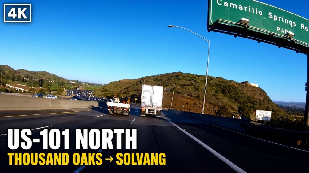
A northbound traveler on U.S. 101 leaves the Santa Barbara coast and climbs toward Gaviota Pass, where the highway threads the narrow gap that Gaviota Creek has cut through the Santa Ynez Mountains. Northbound lanes enter the 1953 concrete tunnel while southbound traffic follows the older surface alignment through the canyon. Once past the pass the road drops into the Santa Ynez Valley. The terrain opens abruptly from the constricted gorge into a broader basin of oak-dotted hills, open grassland, and the first commercial vineyards. The Santa Ynez River runs roughly parallel to the highway for a stretch, its course still shaping the low ground that the road follows. The modern pavement is smooth and multi-lane, yet the sequence of landforms remains the same one that earlier travelers recognized: a pass, then a valley floor.
At the Buellton exit the main line meets State Route 246. A short drive east on that side road reaches Solvang and, just beyond it, Mission Santa Inés. The exit itself sits near the old junction where the state highway alignment of the early twentieth century crossed the valley floor. Most through traffic continues without stopping, but the side road still connects the freeway to the Danish colony and the mission that gave the valley its name. North of Buellton the highway runs through open ranch country that has gradually added vineyards and horse properties. The hills remain low and rolling; the road stays on the valley floor rather than climbing another range. Occasional frontage roads and older alignments appear beside the freeway, reminders that earlier pavement once ran closer to the ranches and the river crossings.
Farther north the Santa Ynez Valley gives way to the broader Santa Maria Valley. The highway crosses the Santa Maria River and continues through flat agricultural land that has long supported row crops, dairies, and, more recently, extensive vineyards. Towns such as Santa Maria and Orcutt sit on or near the route, yet the freeway largely bypasses their older commercial cores. The landscape here is wider and more open than the Santa Ynez, with fewer abrupt hills until the road begins its gradual approach toward the Nipomo Mesa. The mesa itself is a raised terrace of older marine deposits that lifts the highway slightly above the surrounding valley floor. From the mesa the road descends again toward the coastal plain and the approaches to San Luis Obispo.
Throughout this sequence the modern landscape still reflects the older pattern of valleys and passes. The Gaviota cut remains the single practical gap through the Santa Ynez Mountains for a coastal highway. Once inside the valleys the road follows the low ground that has always offered the easiest travel between water sources and ranch lands. Vineyards and subdivisions have replaced some of the open grassland, and the freeway has straightened a few curves that earlier alignments followed more closely, yet the fundamental geography has not changed. A traveler still moves from a mountain pass into a river valley, crosses successive agricultural basins, and rises onto the Nipomo Mesa before the final descent toward San Luis Obispo. The exits and interchanges organize access to the towns, but the drive itself continues to trace the same succession of landforms that organized Chumash trails, mission-era movement, Mexican ranchos, and the first state highway. The pavement is new; the sequence of country it crosses is not.
The same valleys and passes have organized movement through this corridor for centuries. Chumash communities moved seasonally along the Santa Ynez River and its tributaries, using the natural gaps through the mountains and the open grassland for hunting, gathering, and trade. Spanish expeditions and later mission parties followed those same low routes because the terrain offered water, forage, and the least resistance between coastal settlements and inland valleys. After secularization the Mexican ranchos continued to rely on the valley floors; cattle and vaqueros moved where the grass and the river crossings allowed, and trails shifted with floods or ranch gates rather than following a fixed line. Nineteenth-century stage routes and wagon roads used the identical sequence of Gaviota Pass, the Santa Ynez Valley, the Santa Maria Valley, and the rise onto the Nipomo Mesa. The first state highway under the 1909 bond act, the 1926 U.S. 101 designation, and the later freeway all stayed within the same geographic frame. Each generation chose a slightly different surface and a slightly different exact alignment, yet none of them left the valleys that the land itself had already defined.
What changed was the surface, the speed, and the story told about the road. Early travelers measured a day’s progress by the condition of a ford or the steepness of a grade and by the strength of the animals that pulled the load. Mission neophytes and rancho workers moved goods and livestock according to the agricultural calendar and the limits of pack animals or ox carts. Stage passengers endured mud, dust, and bone-jarring hours because the corridor was still the practical link for mail and people. The state highway and then the freeway replaced those limits with pavement, bridges, and eventually grade separations. A journey that once required a full day or more between the Santa Barbara coast and San Luis Obispo now takes a fraction of that time. The El Camino Real Association’s bells and the later highway markers attached a single romantic name to a route that had never been continuous in the way the story claimed. The myth proved useful for tourism and for bond campaigns, yet it did not alter the underlying geography.
What has not changed is the land that still dictates the line. Gaviota Pass remains the single practical coastal gap through the Santa Ynez Mountains; the 1953 tunnel simply allowed four lanes without widening the historic cut further. Once inside the valleys the highway follows the low ground beside the rivers and across the former ranch lands. The Nipomo Mesa still lifts the road above the surrounding plain before the final approach to San Luis Obispo. Vineyards, subdivisions, and freeway interchanges have replaced open grassland and seasonal tracks, and most through traffic now passes the towns on exits rather than through their older streets. Yet a traveler who leaves the freeway at Buellton still reaches Mission Santa Inés and the Danish colony on the same side road that has connected the valley floor to those places for generations. Old concrete, stage-era grooves, and abandoned alignments remain visible beside or under the modern pavement. Daily life along the corridor has shifted from seasonal ranch work and stage stops to agricultural production, tourism, and the ordinary services that serve a high-speed highway. The importance of the long continuity lies in that persistence of geography. The surface and the speed have changed with each era; the valleys and the passes have not. The present freeway is only the latest layer laid across a corridor that the land itself has organized for as long as people have moved through it.

Cold water that lasts the whole corridor. The Stanley IceFlow 30 oz Flip Straw tumbler keeps drinks cold for 12 hours with a leak-resistant lid and easy-carry handle, simple insurance against the long open stretches between Solvang and San Luis Obispo. See the Stanley IceFlow on Amazon
The history of the corridor is still readable on the modern drive for anyone who knows where to look. North of the Gaviota Tunnel the land opens into the Santa Ynez Valley exactly as it did for earlier travelers. The freeway follows the low ground beside the river and across former rancho lands. At the Buellton exit a short drive east on State Route 246 reaches Solvang and Mission Santa Inés. The mission buildings, rebuilt and restored after the earthquake of 1812 and the later neglect of the secularization period, still stand on the bluff above the valley floor. The Danish architectural overlay that appeared in Solvang decades after its 1911 founding sits beside the older Spanish and Mexican layers rather than replacing them. Avenue of Flags in Buellton preserves the alignment that carried U.S. 101 through the town until the 1965 freeway bypass. Older concrete pavement and the remains of earlier bridges can still be found on side roads and frontage alignments. Farther north the rise onto the Nipomo Mesa and the long agricultural stretch of the Santa Maria Valley continue the same succession of landforms that organized movement long before any numbered highway existed.
Daily life along the route has changed with each era, yet the geography continues to set the terms. In the mission period the bells and the agricultural calendar structured the days of the people attached to Santa Inés and San Luis Obispo. During the rancho decades vaqueros and cattle moved according to the seasons and the location of water and grass. Stage passengers measured progress by the condition of the grades and the mud. Early automobile travelers still planned around weather and mechanical reliability. Today most drivers cover the distance between the Santa Barbara coast and San Luis Obispo in a few hours on a multi-lane freeway. They stop at exits for fuel, food, or a visit to the mission and the Danish colony. Vineyards have replaced much of the open grassland, and subdivisions have grown around the older towns, yet the fundamental pattern remains. The pass still funnels traffic. The valleys still offer the easiest line. The side road to the mission still leaves the main highway at the same general place where earlier alignments crossed the valley floor.
The importance of the long continuity is that it explains why the present road looks the way it does. The El Camino Real bells that appear at intervals are twentieth-century markers placed by the 1904 association and later maintained by Caltrans; they do not mark a single continuous royal road from the mission era. The freeway itself is only the latest surface. Earlier concrete, stage ruts, and seasonal tracks lie under or beside it. The alignment decisions made after the 1909 State Highways Act fixed the valley-floor route that later freeways followed. Solvang remained a side trip because the main line stayed on the more direct path through Buellton. These choices were practical responses to terrain, cost, and traffic rather than pure historical reconstruction. What a traveler sees today is the accumulated result of those responses. The corridor has never been a single fixed road. It has been a sequence of valleys and passes that successive generations have used, improved, and storied in different ways. The modern highway makes the distance easy. The older landscape, still visible at the exits and on the side roads, shows why the line was there in the first place and how each era adapted it to its own needs.